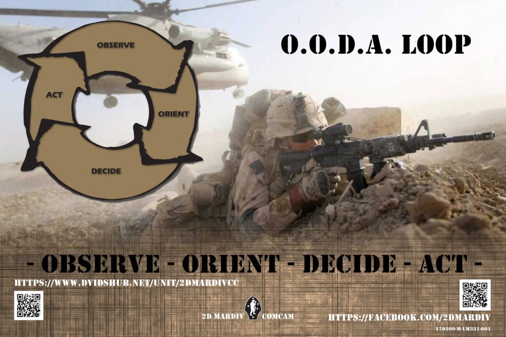
Standard Replenishment: Navies Help Each Other at ‘Speed of Combat’

Capt. Bobby Summers, master of USNS Ericsson (T-AO 194), supervises a replenishment at sea with the Japan Maritime Self-Defense Force’s, helicopter destroyer JS Ise (DDH 182). Ericsson provides critical supplies to U.S. Navy and partner nations’ ships operating in the Indo-Pacific Region. MILITARY SEALIFT COMMAND FAR EAST / Jeyh Janik

Navies that operate frigate-sized ships and larger will generally need to provide for a replenishment-at-sea capability, but many of those navies do not have large replenishment ships that can operate on extended missions to sustain their ships while deployed, or one may not be present where their warships are operating.

They can, however, be supported by oilers and replenishment ships from other navies, as long as both the combatants and logistics ships are built and operated to the international standard. When navies that follow that standard, there is a much large force of replenishment vessels for everyone.

According to Cmdr. J.H. “Han” van Huizen, NATO Maritime Command Branch head for Logistic Operations & Exercises, both NATO and the nations have collective responsibility for the logistic support of alliance opera­tions and missions (AOM).

“The nations are responsible for ensuring that maritime units and formations assigned to NATO are properly supported by an effective and efficient tailored logistics structure for AOM, including a proportional contribution to theater-level support capabilities,” he said.

“From the NATO perspective, logistics is a national responsibility, but the nations and NATO authorities have a collective responsibility for logistic support of NATO’s multinational operations. Logistics support must be sufficient to sustain maritime operations and is required in theater to support forward deployed maritime forces,” van Huizen said. “When operating in a task group, for example, the ships will coordinate efforts like replenishment at sea [RAS] with designated fleet logistic coordinators and a group logistic coordinator. Cooperation among the nations and NATO authorities is essential.”

Interoperability is achieved because the navies have agreed-upon standards. They use the same rigs, procedures, terminology and documentation. Interoperability starts with design standards and includes the concepts of operations and operational procedures. NATO and partner nations can do this because they have agreed to follow the same standards and the same manual.

The U.S. Navy’s manual for underway replenishment is essentially the same as the NATO manual, which provides conceptual interoperability from the start.

“ATP-16 is the NATO document that has the parts to procedures on how things are going to happen. This is the document to make sure all those countries that are listed in the manual can interact easily with each other,” said Richard Hadley, an underway replenishment (UNREP) engineer with Naval Surface Warfare Center Port Hueneme Division in California.

To achieve interoperability, the visual signals have to be the same on both the delivering and receiving ships. The sound-powered phones have to connect the same way. Emergency breakaway procedures have to be the same.

Interoperability has to be designed in from the beginning, not done as an afterthought. “There’s a device on a cargo receiving station called the NATO Long Link, and the pelican hook on all of the delivering ships will connect with that. It’s the same on all of the ships,” Hadley said. 

“We’re the engineers who design and support the UN­REP system, not the people who are out there every day conducting these evolutions, but we take our work very seriously,” Hadley said. “It has to be safe. It has to be effective and reliable. You don’t want the fleet to have logistics problems, because your system goes down. If the system doesn’t work, the fleet won’t be able to do what they need to do. We always have to be aware of that.”

Singapore-based Commander, Logistics Group Western Pacific (COMLOG WESTPAC)/Task Force 73 (CTF 73), is the U.S. 7th Fleet’s provider of combat-ready logistics, operating government owned and contracted ships to keep those ships armed, fueled and fed.

“Reliable and responsive sustainment enable ships to remain at sea — ships at sea are key to the global presence that underpins regional security and stability,” said Cmdr. Rob Paul, deputy assistant chief of staff for Logistics, COMLOG WESTPAC/CTF 73. “Replenishments at sea are one way we enhance our interchangeability with friends, partners and allies in the region. This is true whether we are resupplying other nations, or they are resupplying us, because our partners and allies are able to supply us with fresh food, stores and fuel, and we can do the same for them. We can sustain nearly any partner or ally in this region and vice versa. That is at the core of interchangeability and interoperability.”

According to Paul, the U.S. has conducted replenishment operations with Australia, France, India, Japan, Republic of Korea and Singapore. The U.S has received cargo and/or fuel from Australia, Japan and Republic of Korea in the past year.

The U.S. Navy’s fleet replenishment oiler USNS Big Horn (T-AO 198), left, conducts an underway replenishment with the French Navy’s amphibious assault ship FS Tonnerre (L 9014), while the French frigate FS Surcouf (F711) follows. FRENCH NAVY

Safety First

Because replenishments and refueling at sea are inherently dangerous, Paul said the most important attribute allied and partner navies share are basic safety features.

“Prior coordination before any RAS helps ensure safe and efficient operations. While there are standard operating guidelines we publish in an unclassified manual, before each replenishment operation we transmit an official message that reiterates agreed upon procedures and guidance regarding many factors from ship speed to acceptable weather,” he said.

After safety, it becomes a matter of efficiency, such as the standard NATO fittings that can provide the optimal fuel transfer rates.

“It’s also important to ensure you are delivering the right cargo,” Paul said. “We coordinate that at the fleet logistics level. Our CLF fleet replenishment oilers and dry goods and ammunition ships can receive cargo, stow it and transfer it using the same general process as any partner or allied cargo vessel.”

The U.S. and allied and partner navies follow the same protocols or procedures to seamlessly deliver or receive fuel, ammunition and stores at sea. 

Paul said great advances are being made in the areas of authorities and legal considerations as well. “We are making strides is at higher levels of engagement, specifically, navigating through the complex accounting process,” he said. “Both we and our partners are committed to strengthening and simplifying these channels to ensure the comprehensive process — from ordering, scheduling, paying and delivery — moves at the speed of combat.”

“At the tactical level, we routinely prove that our procedures really are very similar,” Paul said. “What’s important is that we continue working and exercising together, because through those exchanges we continue building a shared confidence in our interchangeability and interoperability during the sustainment process.”

One example of enhanced interoperability is the Japanese Maritime Self-Defense Force (JMSDF) assigning an officer to the CTF 73 staff to serve as a liaison regarding replenishment at sea with their respective ships. The liaison officer works with the CTF 73 logistics officer in planning and executing combined replenishment operations to ensure the efficiency of combined logistics operations between the JMSDF, U.S. Navy and Military Sealift Command.

Japanese Maritime Self Defense Force Towada-class replenishment ship JS Towada (AOE 422) sails connected to U.S. Navy Arleigh Burke-class guided missile destroyer USS Barry (DDG 52) during an underway replenishment during routine operations in the East China Sea. U.S. NAVY / Lt. j.g. Samuel Hardgrove

Tactical Edge

U.S., Japanese and French ships demonstrated the ability for allied and partner navies to successfully replenish each other’s ships this in May in the Philippine Sea when fleet replenishment oiler USNS Big Horn (T-AO 198) conducted a replenishment-at-sea with the French navy amphibious assault ship FS Tonnerre (L 9014), and JMSDF Replenishment Ship JS Masyuu (AOE 425)replenished the French Navy frigate FS Surcouf (F 711).

“Replenishment-at-sea is a maneuver of special interest for our Navy assets operating in the Indo-Pacific,” said French navy Rear Adm. Jean-Mathieu Rey, joint commander of French armed forces, in Asia-Pacific. “First, it highlights the excellent level of tactical interoperability between partners, as RAS is a complex maritime operation, requiring perfect seamanship training and technical coordination. Then, it allows our respective naval forces to operate durably at sea without the constraint of replenishment port visits. Today, in the specific context of the current pandemic, whereas access to some harbor is denied to our navy ship, this capacity is of first importance.”

Because of the interoperability and standard procedures, crewmembers involved with underway replenishment, either the delivering or receiving ship, know what to expect from the ship alongside.

“Coordinating operations throughout 7th fleet with our allies and partners ashore and afloat is made simple through the use of standardized publications and instructions and operations are conducted safely and professionally IAW standardized procedures,” said Ryan Snow, a cargo mate aboard USNS Charles Drew (T-AKE 10), currently operating in the Indo-Pacific AOR.

“We apply common skills, together with a number of international navies in support of operations at sea,” said Charles Drew’s 2nd Officer Brian Knudson. It is by these common procedures and safety protocols, that we are able to sustain joint operations.”

While it may appear to become routine, it isn’t.

Underway replenishment “happens all the time, every day, somewhere in the world, but it’s inherently dangerous,” said Hadley. “All sorts of bad things can happen if you don’t have professionals that know what they’re doing.”


Q&A: Charles “C.J.” Johnson-Bey and Jandria Alexander, Booz Allen Hamilton

A poster created using digital illustration software to advertise the “observe, orient, decide, and act” cycle (OODA LOOP) in order to inform Marines and Sailors of the importance of the decision making process. U.S. MARINE CORPS / Lance Cpl. Alexander N. Sturdivant

Dr. Charles “C.J.” Johnson-Bey is a leader in electro­magnetic technology solutions for Booz Allen Hamilton’s commercial and defense clients. Based out of the company’s Belcamp, Maryland, office, he develops and executes innovative technology strategies that reflect evolving markets and technology dynamics.

Johnson-Bey has more than 25 years of engineering experience spanning cyber resilience, signal pro­cessing, system architecture, advanced prototyping and hardware. In leading Booz Allen’s engineering and science community, he inspires leaders and promotes innovation, collaboration and sharing of intellectual capital across the firm.

Prior to joining Booz Allen, he was a research engineer at Motorola Corporate Research Labs and Corning Inc. In addition, he taught electrical engineering at Morgan State University. He also worked at Lockheed Martin Corp. for 17 years, where he galvanized the company’s cyber resources and led research and development activities with organizations including Oak Ridge National Laboratory, Microsoft Research and the GE Global Research Center.

Johnson-Bey is a co-principal Investigator of the National Science Foundation’s Engineering Research Visioning Alliance, which identifies bold and societally impactful engineering research directions that will place the U.S. in a leading position to realize a better future for all. He serves on the Whiting School of Engineering Advisory Board at Johns Hopkins University and the Electrical and Computer Engineering Advisory Board at the University of Delaware. He is also on the Cybersecurity Institute Advisory Board for the Community College of Baltimore County.

Johnson-Bey received both an M.S. and Ph.D. in electrical engineering from the University of Delaware and a B.S. in electrical and computer engineering from Johns Hopkins University. 

Charles “C.J.” Johnson-Bey. BOOZ ALLEN HAMILTON

                                             …

As a cybersecurity leader focused on Navy-Marine Corps clients and cross-market research and development, Jandria Alexander guides the implementation of innovative, technology solutions that drive transformational business growth. She’s a subject matter expert on cybersecurity engineering and assessments, resilient platforms and space systems, infrastructure, and multidomain mission systems.

A nationally recognized cybersecurity expert, Alexander has participated in several National Academy of Sciences studies related to cybersecurity research and new aviation technologies. In 2014, she was appointed by former Virginia Gov. Terry McAuliffe to serve on the bipartisan Virginia Cyber Security Commission to expand the state’s economic footprint in cyber technology and protect critical infrastructure from cyber threats. She led the effort’s unmanned systems cyber­security industry, government and academia consortium.  

Over the length of her career, Alexander has provided cybersecurity and digital transformation leadership, market strategy and solution development for the Department of Defense and the intelligence community as well as many civil and commercial organizations. Prior to joining Booz Allen, she was a cybersecurity leader in engineering and technology at a federally funded research and development corporation.

She holds a B.S. in computer science from Brandeis University and an M.S. in information systems from American University.

Johnson-Bey and Alexander discussed unmanned systems’ technical and operational challenges with Senior Editor Richard R. Burgess.

Jandria Alexander. BOOZ ALLEN HAMILTON

With the Navy’s Project Overmatch in progress and having released its Unmanned Campaign Plan, what is the nature of some of the technical challenges the service is trying to overcome?

JOHNSON-BEY: There’s always an accelerated trend of technology that catches us by surprise, with technology being used in an unexpected way, creating a new set of problems. In cyber, for one example, when you get things too integrated, you actually introduce some vulnerabilities that you hadn’t thought about before. All these things have multi-dimensions to them. I like being in this space, because there’s always a new problem to tackle and it challenges you to think outside the box. And the more we collaborate on these challenges, the smarter we get.

Unmanned maritime systems seem to bring more challenges, from preventing boarding to cyber intrusion and keeping communications, navigation and targeting networks open. How can command and control be sustained in a communications-denied environment?

JOHNSON-BEY: A new book that came out in mid-March — “2034: A Novel of the Next World War,” [by Elliot Ackerman and U.S. Navy Adm. James Stavridis] — talks about the future, 2034, and war in the South China Sea. It talks about cyber and how we handle it. The Chinese have a capability that we did not expect and that wipes out our comms. How do we deal with that? The reason why I bring that up is because it forces you to think about how we’re pushing ahead with new technology, but what if something just comes out of the blue and we have no comms? The new technology we’ve become reliant upon to carry out missions is suddenly not available. For example, the F-35 [strike fighters] are taken over [by cyber intrusion], the ships at sea are taken over, no comms; so, it’s really interesting.

The U.S. Navy has been thinking about the challenges of operating in a communications- or GPS-denied environment. What do you think of these challenges?

JOHNSON-BEY: A lot of old technology is pretty doggone robust, and it had to be. So, we can’t get too far ahead of ourselves. I’m a technologist through and through with a Ph.D. in electrical engineering. I’ve been doing this a long time. But the thing I will say is that we don’t want to become too reliant on our technology or the latest technology, and I think that’s where innovation comes in. You get innovative when you have constraints. If I don’t have any constraints, then I don’t need to be innovative. I can just do what I want to do when I want to do it. But the U.S. and its allies have long been used to using the electromagnetic spectrum to communicate when they want, wherever they want and for however long they want. That’s no longer going to be the case. So, we really do need to think about how we complete the mission in a denied or congested environment. The solutions might not be brand new technology but might be an innovative use of some technology that we’ve had in the past.

Security [of electronic systems] is always an issue and we really look at it from that OODA [observe, orient, decide, act] loop. How do we increase the speed of decision-making for U.S. forces and our allies and decrease if for our adversaries? Part of that is to address it from the OODA loop in the constrained or denied or congested environment. The speed of decision-making saves lives. So, we’re developing and investing in technologies that are looking at the security in that space. We’re also looking at swarms in that space, distributed platforms, AI [artificial intelligence], distributed processing and processing at the edge. So, we are investing in those areas. Jandria [Alexander] actually has led one of our projects in there last year.

ALEXANDER: The key point to your question is what happens in war. We can leverage alternate communication systems, but our goal is the communications at the tactical edge, from platform system to platform system.

As mentioned, complexity and threats increase with mission operations and communications across mul­tiple UAVs groups, as well as unmanned and autonomous systems across domains. Platform systems in air, ground or undersea are critical part of force operations. As such, rapid data processing or sensor and RF data become differentiators. We’ve focused on increasing autonomous processing in a secure manner at the tactical edge and secure cross platform communications, whether they be large or small. If we can provide edge processing in a fashion that’s secure, design against a common architecture that’s driving our solutions, and be able to add advanced artificial intelligence and machine learning algorithms to process different data sets, in an extensible and modular fashion, we are able to efficiently increase capabilities without having to rebuild complete systems from scratch.

From an operational perspective, we’re able to respond quickly based on the algorithmic results processed on the platform. In a world of increased connectivity, cybersecurity needs to be addressed as an integral part of all architectures and built into the systems, including edge systems. Integrated security provides functionality and assurance that we can detect anomalies in parameters and processing that could throw off the compute cycle and exhaust the local resources degrading or disabling necessary platform functionality. And all of a sudden, we get into a situation where we can’t operate. So, we want to be able to make sure we monitor those inputs, and we look for anomalies in the different types of data input. Once we do that, we can be a little more confident about the processing that’s occurring at the platforms.

For each area in platform systems — communications, processing, algorithms and cybersecurity — there are technologies and best practices that support optimal and modular system development. Booz Allen has taken that problem set and divided it into the various functions bringing subject matter experts together into cross-functional project teams. The resulting systems are then able to incorporate integrating our solutions, third-party solutions and government solutions.

What is edge processing?

ALEXANDER: Platform systems range from manned to unmanned systems, including very large airborne to undersea platforms of various sizes. The platform systems have various sensors and functionality to support the mission. As data is collected on the platforms, edge processing allows for rapid analysis, decision support and specific maneuvering locally without having to transmit the data to a data center for central processing. During contested operations, the tactical asset is the edge. We want to be able to make computing decisions and react to those computing decisions based on what occurs at the edge for onboard sensors on the unmanned system as opposed to sending all the data back to a ground system. The local processing enables autonomous operations at the edge.

JOHNSON-BEY: Getting into denied environments, you’ve got to get innovative, so if you cannot get back to the [data] cloud or if you cannot get [the platform] back or time won’t allow, how do we do that computing right where you need it with information that you need to get the mission completed?

Does this create a weapons release authority problem for the man in the loop if you don’t have the central command there to some degree?

ALEXANDER: That’s right. So, we have to be flexible. We have to recognize that there’s a combination of manned and unmanned systems and decision points. As we become more comfortable and have more results and training our confidence and ability to trust the behaviors [of the unmanned systems] will increase. During situations where the volume of data and the need for rapid decisions are critical, edge processing and autonomy provide options that were not previously available. Systems have matured little by little. It’s not going from totally manned to totally unmanned, but it’s that combination, human in/on the loop, where there’s a recommendation and acknowledgment and recommended course of action.

JOHNSON-BEY: I’ve heard the term “human on the loop” instead of “in the loop.” [Humans] are “on the loop,” where they’re helping to make the decisions as needed. But the way things are moving, we need to be able to, in some instances, operate at the speed of computation because — particularly with things like hypersonics or getting so much data — when you look again at that OODA loop, it could just be that you can’t make a decision fast enough, so you’re going to need some AI and autonomy. You’re going to have some overall decision-making, but you are going to have to have some trust or some delegation of the ability to complete a mission done at the edge or where communication is congested or denied.

ALEXANDER: The other point is, it’s not only the speed but it’s also the volume. We have much better sensors right now. We’re collecting so much data that the time to process has to rely on automation. We have to figure out ways to streamline and synthesize the data to make decisions. Credibility of data also is an aspect. We want to be able to weigh the sources and understand which inputs are most trusted to rate and weigh the results. We need AI/ML [machine learning] algorithms that have been trained on actual and synthetic data sets. In an ideal case, the data processing is based on rich data sets, where we have full information; in the worst case, we have limited and lower quality information. The challenge is to develop an edge processing capability that can optimize operations.

JOHNSON-BEY: One of the things we’re investing in is, for example, the project that Jandria’s been working: platform agnostics, so a system can go on an unmanned aerial system, an unmanned underwater system, an unmanned surface system or an unmanned ground system. That unmanned piece is going to grow if the Navy wants to reach 355 ships or that next-generation Navy capability. So, what we’re looking at is how do we help a naval system grow into the unmanned space so that we can advance our capability, ability to make decisions and our ability to complete the mission with the unmanned aspect.

ALEXANDER: That brings up another good point. Large aerospace satellite systems, for example, used to take 20 years to build and deploy. We are transitioning to building constellations with disaggregated functionality. The key is to build smaller satellites — with more specialized function — that collectively perform complex missions. As we break up functionality, we build systems faster. They can be simpler and more secure. We can then integrate those data outputs from the various functional systems to support advanced decisions and assorted missions. Every platform doesn’t have to be all or nothing across every domain. Edge processing can also help with collecting additional or specialized data sources. Specialized platform systems can collect the unique data source provide it to the processing platform and then as the data gets synthesized, the mission advances.

Are micro-satellites part of the solution?

ALEXANDER: Absolutely. We have many examples in communication systems, with platforms that perform certain functions but may be perishable in the long term and don’t persist beyond short-term operations. As disposable assets, we don’t need them to be as rigorous.  

How is your company supporting Project Overmatch and other programs?

JOHNSON-BEY: Project Overmatch is something that the Navy is focused in on and that goes everywhere from networks like the tactical grid to the infrastructure that deals with computer storage and tech stacks to the data architecture and then the tools and analytics like AI and ML and those different applications. So, what we’re focusing in on and investing in are these specific areas so that we can get some minimum viable products out. As the Navy grows its capabilities, we’re going to be able to provide some of these solutions to them. And then, as we all get smarter, we will continue to improve. It’s about speed, getting something useful out quickly, something I really do believe saves lives. So, we’re focused on being able to make decisions quickly, to field things quickly, to be very nimble in order to get from idea to deployment efficiently. We’re looking at how do we do things in a very quick way and demonstrate it in the marine environment and in the environment in which it will be used. We’re also looking at the challenge in a multi-domain aspect and how to create products to help the Navy complete its missions.

ALEXANDER: So, we’re tracking Project Overmatch very closely. This includes solutions for the enterprise as well as the tactical edge. The tactical edge is exactly the piece we’ve been talking about — the edge processor — that is one piece of the overall architecture and mission. Beyond the technology, is how the technology is integrated into legacy as well as future systems, as well as the training and the governance around it. Those are other parts that will drive adoption ultimately resulting in more successful mission capabilities.

Where is your company’s support to the Navy directed?

ALEXANDER: We support all the Navy echelons. We support the warfare centers focused on technical solutions and prototypes. We support program offices across Navy System Commands, the Echelon II systems commands — Naval Information Warfare Systems Com­mand [NAVWAR], Naval Air Systems Command, Naval Sea Systems Command. Overmatch is certainly one of those programs that is occurring at all of the levels.

JOHNSON-BEY: One other thing to drive home is that we also are working with the Office of Naval Research [ONR]. We have multiple programs there and we are looking to increase our collaboration with them. We think that is certainly important. That’s where you start getting in with the new ideas, new capabilities, the innovation, and we think that’s a perfect place for us to be. We do a significant amount of work with ONR today, and we’re looking to increase that as well as with the warfare centers but particularly with ONR. Fun fact: Our relationship with the Navy goes back 80 years continuously.

ALEXANDER: We are engaged with our clients to provide thought leadership and diligent execution. Critical initiatives have many aspects. There’s often a policy piece, an acquisition piece and a solution piece. We want to make sure that our solutions align with the missions and provide enhanced operations and that the policies consider all of the various stakeholders and the overall strategic intent. We collaborate across our program and functional teams to address mission requirements. This allows us to leverage the perspectives that are needed, collect lessons learned and bring our innovation leads to solve the emerging problems of our clients.


Q&A: Heather H. Quilenderino, Director, U.S. National Ice Center and Commander, U.S. Naval Ice Center

From left: Cmdr. Heather H. Quilenderino, director of the U.S. National Ice Center (USNIC), Cmdr. Ruth Lane, former USNIC commanding officer, Cmdr. Kristen Serumgard, U.S. Coast Guard, and John Parker. Quilenderino, Serumgard and Parker are co-directors of the North American Ice Service. U.S. NATIONAL ICE SERVICE

Cmdr. Heather H. Quilenderino is the director, U.S. National Ice Center, and commander, U.S. Naval Ice Center.

She qualified as a surface warfare officer on a guided-missile cruiser before laterally transferring to the naval oceanography community. She graduated from the Massachusetts Institute of Technology/Woods Hole Oceanographic Institution joint program in oceanography, earning a Master of Science in oceanographic engineering, and earned her Ph.D. in meteorology from the Naval Postgraduate School.

She served as staff oceanographer for Naval Special Warfare Group 10, and for commander, Carrier Strike Group 10. Prior to assuming command of the Naval Ice Center, she served as the Operations Officer, Fleet Weather Center Norfolk. In 2016, she was awarded the Oceanographer of the Navy Commander Mary Sears Award.

Quilenderino discussed the operations of the National Ice Center with Senior Richard. R. Burgess. Excerpts follow:

What is the mission of the U. S. National Ice Center and the Naval Ice Center? What is the difference between the two?

QUILENDERINO: There is a slight difference, but we do have a mission that is one and the same, and our mission is to provide global-to-tactical scale snow and ice products, ice forecasting, and other environmental intelligence services to the U.S. government. The U.S. National Ice Center [USNIC] is made up of three agency components, so the Naval Ice Center [NIC] is the core component and the largest — the contribution from the U.S. Navy — and we are our own command. And so, I serve as the commanding officer of the Naval Ice Center as well as the director of the U.S. National Ice Center.

Our NOAA [National Oceanic and Atmospheric Administration] component is the Ice Services Branch of the Ocean Prediction Center, which is under National Weather Service, our newest realignment in May 2020. We also have a small Coast Guard component, which aligns under the Office of Waterways and Ocean Policy at Coast Guard Headquarters.

How is the USNIC funded?

QUILENDERINO: It’s a combination of funding from the Defense, Commerce and Homeland Security departments. This year [2021], our budget is approximately $13 million.

What types of analysis or mapping does the USNIC do?

QUILENDERINO: We don’t necessarily do ice mapping, but we do ice analysis, and I use that distinction between because, particularly, in my mind, ice mapping would be more of something that you would do when you are actively in reconnaissance mode. In general, our day-to-day analysis is a wider area analysis that we then fine-tune to a higher resolution. We do that with, really, any data that are available, because the Arctic is a very data-sparse region. We are looking for anything from satellite data to buoys and models, anything that’s available within the region that can provide us with information on the ice conditions, with satellites being our primary, models being our additional input and then, if buoys are available in our region of interest, we use them to validate the overhead sensing to provide additional information.

We do have some specific examples of ice mapping. What comes to mind is ICEX [Ice Exercise] conducted by the Arctic Submarine Lab [ASL]. When they are selecting the ice floe for the ice camp for that exercise every two years, they do aerial reconnaissance flights to select the floe generally with our analysts on board. We send one of our analysts as well as one of our Navy lieutenants, who leads the mobile environmental team, and they will be part of the pioneering flights to locate potential floes. The pilots will conduct the virgin landings on the floes and do coring samples or tow a sled to do more rigorously map the ice to get the conditions. These are collaborative projects that we do with University of Fairbanks. These are things that we will add in with our partners when doing specific mission operations like that with ASL that we wouldn’t normally do.

What sensors and platforms does the USNIC use for ice data?

QUILENDERINO: Of our newest, exciting tools, one is operational, and one is still in development. The Earth System Prediction Capability is a new operational ensemble at FNMOC [Fleet Numerical Meteorology and Oceanography Center] in Monterey, California. It provides us with a 45-day ensemble of sea ice forecasts and is the first medium-range ensemble forecast that we have for sea ice. We began testing it two years ago with the Naval Research Lab, and it has shown extremely positive results in several of our tailored missions, as well as ICEX 2020 in predicting long-term location and concentration of sea ice and multi-year ice.

The second project that we are working on in collaboration with NGA [National Geospatial-Intelligence Agency] Research Division is called Snowfox. It’s an AI/ML [artificial intelligence/machine learning] project where they’re working on an automated sea ice classification algorithm to help us manage the large quantity of synthetic aperture radar imagery that’s coming in from satellites. It will be able to automate some of the routine ice analysis that we do, so that our analysts can focus on areas where tailored mission support is going on. So, we provide one of our master ice analysts with their skills set to the project in collaboration with NGA, and that has shown some exciting results. We look forward to bringing that into operations in the next two years at the USNIC.

Does USNIC have dedicated satellites, or does it piggyback on those of other agencies? 

QUILENDERINO: We don’t have dedicated satellites for us and for ice reconnaissance. So, all of the satellite resources we use are usually multipurpose satellites, but, really, any satellite that has visible, IR [infrared], microwave or synthetic aperture radar [SAR] can provide data that will be of use to us in our ice analysis. We use a variety of U.S. and foreign satellites. For example, we use a significant number of NOAA satellites where we’re using a multitude of visible, IR and microwave sensors. Our two primary SAR satellites are RadarSat 2 and Sentinel. SAR is our No. 1 choice for ice analysis, because it is an all-weather capability and does not have any daylight requirement as there is with visible, which is very important in the polar regions.

ICESAT-2, a NASA satellite for ice reconnaissance, is more applicable to science and research applications, because it has too much time latency to be applicable for operational use. And, so, we rely on RADARSAT-2, the Canadian satellite and a Sentinel, which is operated by the European Space Agency. We receive data from Sentinel through an agreement where NOAA is able to access that in near-real time.

The Northern View Agreement, which is a U.S./Canadian agreement that we benefit from through NGA, provides a significant amount of funding for our RADARSAT-2 imagery and supports almost all of the tailored support imagery ordering that we provide to U.S. government customers in the Arctic.

Now, we do not provide tailored support for foreign entities unless they are in cooperation with a U.S. government project. For example, just this past year, the Norwegian vessel Svalbard picked up an ONR [Office of Naval Research] mission to transit the Arctic and retrieve some ONR buoys. This was supposed to be part of the Coast Guard icebreaker Healy’s mission and needed to be reassigned after the Healy’s casualty last summer, so the Svalbard was assigned on relatively short notice, and we were able to provide direct support to Svalbard because of their support of the ONR mission. And we had a collaboration with the Norwegian Meteorological Office.

Is the USNIC able to draw upon foreign data and observations to some degree?

QUILENDERINO: We do. We have a few critical international partnerships, the first being the North American Ice Service [NAIS], a partnership between the Canadian Ice Service, USNIC and the U.S. Coast Guard. It is a critical partnership both for working through the data-sharing of the new RADARSAT Constellation Mission that will replace RADARSAT-2, but also, we share responsibility with things like the Great Lakes ice season as well. USCG International Ice Patrol is the USCG core member of NAIS, and Canadian Ice Service is the Canadian core member, along with USNIC, [they] share responsibility for the North Atlantic iceberg season. This partnership is incredibly beneficial throughout the Arctic because of our overlapping areas of interest and partnership.

The second partnership is the International Ice Charting Working Group [IICWG], a collaboration of all of the world’s ice services in either hemisphere. Our goal is to create a collaborative environment where we can maintain the same standards and training throughout the globe. If you are a mariner receiving support in one area and you are transiting around the world and need to receive publicly available ice services from another country’s ice service, you could be familiar with their products, because we’re all meeting the same WMO [World Meteorological Organization] standards. We also are able to develop decision support products for mariners that can be useful regardless of country of origin when we’re talking about protecting safety of navigation. So, through IICWG, one way that we are able to leverage this partnership is we actually use their local area expertise for ice analysis in the Baltic Sea region. We use ice analysis from the Finnish Meteorological Institute and the Swedish Meteorological and Hydrological Institute as part of our global analysis, because they are the experts in their area of the world.

Finally, the final partnership I wanted to mention is the International Arctic Buoy Program. This directly ties to foreign observations. There are 12 nations that contribute to the International Arctic Buoy Program, and our goal is to maintain a network of buoys that are reporting throughout the Arctic. All of those buoys contributed through this program are publicly available data that are transmitted over the Global Telecommunications System, and into model data worldwide. So, all atmospheric models from any country can pull this data and use it in their weather models to improve forecasts.

The Seawolf-class fast-attack submarine USS Connecticut (SSN 22) surfaces in the Arctic Circle during Ice Exercise (ICEX) 2020. ICEX 2020 is a biennial submarine exercise which promotes interoperability between allies and partners to maintain operational readiness and regional stability, while improving capabilities to operate in the Arctic environment. U.S. NAVY / Mike Demello

What agencies are your customers?

QUILENDERINO: Primarily the Navy. Our No. 1 Navy customer always has been and still is the submarine force as they have been in the Arctic for decades. We continue to support them on a daily basis. We have seen an increase in naval surface forces requesting our support primarily through individual ships that are doing high-north deployments. In the past few years, we’ve seen a significant increase in support of planning products for Fleet, OPNAV [Office of the Chief of Naval Operations] and SECNAV [Secretary of the Navy] staffs.

On the NOAA side, we do provide tailored support to NOAA ships in their research missions to include things like fisheries missions, some of their autonomous vehicle operations, and their weather forecasting offices in areas where sea and lake ice can impact the local communities. And this linkage was also one of the reasons for the realignment to National Weather Service within NOAA in 2020.

For the Coast Guard, we directly support icebreakers and any other Coast Guard ships that are in or near ice-infested waters and we provide support to various Coast Guard staffs.

So, any U.S. government entity or government-funded entity can request tailored support. For example, an ONR- or NSF [National Science Foundation]-funded scientific mission may reach out and request tailored support from us. And then, as part of NOAA’s weather-ready nation, much of what we do is on our publicly available website, which is also a mobile enhanced site to make it easy for some of our low-bandwidth customers to be able to access that data as they need it.

How do your customers get access to your products?

QUILENDERINO: The majority is through the website. We also use the Navy’s CTG [Commander Task Group] 80.7 portals on the various Navy networks, as well as standard Navy message traffic, email for some of our shipboard customers because then we can tailor products down to meet the bandwidth requirements that they may have. So, you have a single JPEG or very, very small bandwidth or even a text ice bulletin if that’s what they need. And we can also provide just a simple overlay that they can bring into Google Earth or their navigation system or any sort of GIS-enabled visualization system.

The Arctic has been a focus of attention with the thinning and the melting of the icecap. Has that increased demand for your services?

QUILENDERINO: It certainly has. Over the past three to four years we’ve seen over a 20% increase annually in the number of products that have been requested, particularly our tailored support products and especially our climatology and long-range planning products.

One of the things that we have found is that, as we’ve seen the changes in sea ice, that the 30-year climatology is not providing an accurate planning assessment for long-range planning from an operational standpoint because of the significant changes.

We have a product that we call our Trivariate Climatology, which is available on our website. It’s a simple product that provides open water, the marginal ice zone and pack ice from 2007 to present, so a more recent two-week averaged time period over those years. We think that it provides a more accurate assessment when it comes to operational planning than looking at a 30-year record that begins in 1980, due to the more recent changes that we’ve seen in sea ice extent in particular. We’re also looking into updating climatology so that we can provide the best planning products for our operational planners.

What has been the most dramatic change in ice coverage that you’ve observed?

QUILENDERINO: 2020 was the second lowest year on record in the satellite record for minimum sea ice extent during the summer melt season, and during the summer of 2020 we provided a weekly analysis of all the Arctic Sea routes. Normally we provide this for the Northern Sea Route and the Northwest Passage. What most people will refer to as the Transpolar Route is not included in these products because it is generally ice covered. So, for the first time ever, we actually published a product that included all three routes as open. And we produced this product four times between the Sept. 4 and Oct. 2, when all three routes were open. That was very significant from our perspective.

The second is from Project MOASiC, when the [German] icebreaker Polar Stern wintered over in the pack ice for the yearlong project. We did not have anybody on board but we were supporting MOSAiC from our watch floor. They were expecting to see significantly thicker multi-year ice than they found. This is a rather anecdotal example, but I think that this is the other significant change that we’ve seen. Most people focus on the decrease in extent of sea ice, but the thickness of the multi-year ice is also rapidly decreasing which is, of course, decreasing the overall volume of ice in the Arctic and will have implications as we continue to see a reduction in sea ice.

The third thing is the thinner first-year ice that has formed over the winter and is more susceptible to easy breakup and melt faster as the melt season begins. What I have seen in just my short time as director is that we’ve seen these very significant fast breakup events in areas where we haven’t necessarily seen them before. Strong storms may come through either early in the melt season or very late in the melt season and cause a significant change in the amount of sea ice simply because that sea ice along the edge of the extent is very fragile. And so, it’s very easy to break it up and cause a large significant change in a rapid period of time. My analysts observe that these significant events are happening more frequently.

In addition to support of ICEX, what are some other examples of operations the USNIC supports?

QUILENDERINO: The Coast Guard icebreaker Healy is planning their Northwest Passage transit for this upcoming summer — both their primary and secondary routes — off of our planning products and the expected ice conditions. NOAA recently had a Saildrone mission to map the north slope of Alaska, which was the first time full North Slope operations were mapped with autonomous vehicles. Using our products, they were able to safely navigate all the way to the Canadian border and back avoiding all ice and ensuring their vehicles were safe.

And finally, we impact operations by enabling things like fuel- and time-savings when we are able to provide a “easier ice channel” when the [Coast Guard heavy icebreaker] Polar Star is breaking and maintaining an ice channel down at McMurdo Sound in Antarctica for the annual resupply mission called Operation Deep Freeze. We know that they’re going to break the ice channel to get the ships in. If we can find a channel through first-year ice versus multi-year ice, there is a significant fuel, time and, obviously, cost savings to the Coast Guard and to the U.S. government to be able to break and maintain that channel while they conduct their resupply.


USMC Amphibious Capability Critical to Popping Area Denial ‘Bubbles’

U.S. Marine Corps Sgt. Kaleb, a crew chief with Marine Heavy Helicopter Squadron (HMH) 461 Clark sits on the CH-53E Super Stallion’s ramp as the aircraft leaves the USNS D. T. Williams (T-AK-3009), April 5, 2021. 2nd Marine Aircraft Wing is participating in Dynamic Cape 21.1, an operational logistics exercise simulating a Marine expeditionary force’s ability to exercise command and control in a contested environment as well as exercising naval integration in a joint environment. U.S. MARINE CORPS photo by Lance Cpl. Caleb Stelter

Whether operating in the Euro-Atlantic or Indo-Pacific theaters, U.S. naval forces and their allies and partners must confront constrictions in operations — in both peacetime and crisis — generated by adversaries attempting to apply anti-access or area denial strategies, known as A2/AD.

Such strategies are designed to deny access for U.S. and other forces to key waters and coastal regions by inflat­ing A2/AD “bubbles” around, for example, critical choke points at sea or entry points ashore.

In the Euro-Atlantic theater, areas like the Greenland-Iceland-U.K. (GIUK) gap region in the North Atlantic, the Kattegat and Skagerrak Straits that connect the North and Baltic seas, and the Eastern Mediterranean and Black Sea region, especially around the Bosporus and Dardanelles straits, are examples of strategic areas adversaries could attempt to “bubble” by using mines, anti-ship missiles, submarines or strike aircraft. The East China Sea and the southern reaches of the South China Sea are areas of po­tential A2/AD actions in the Indo-Pacific region.

In any Western naval efforts to deter, defend against or deploy through A2/AD efforts, amphibious forces would play a critical role. Deployed at sea to deliver effect ashore, amphibious task groups and the marine forces they insert provide a capability that is critical to popping any A2/AD bubbles.

“Amphibious capability is a strategic capability — the threat of joint forcible entry remains a strategic capabil­ity,” Lt. Gen. Brian Beaudreault, commanding general of the U.S. Marine Corps’ II Marine Expeditionary Force (II MEF), told Seapower. “We’re still going to need an ability in the future to come from an unexpected direction, seize and hold ground, take something of value, and/or destroy something. Whether it’s a light raiding force or a distributed element of a larger whole, amphibious force remains a threat the adversary is going to have to honor.”

The U.S Marine Corps is the United States’ amphibious force. In the Euro-Atlantic theater, the responsibility of generating amphibious presence at sea and delivering amphibious effects ashore rests with II MEF, based on at Camp Lejeune, North Carolina.

The Marine Corps delivers its amphibious effect in part­nership with the U.S. Navy. For II MEF, this partnership is based around its increasingly integrated relationships with U.S. 2nd Fleet, based in Norfolk, Virginia, and U.S. 6th Fleet, based in Naples, Italy.

In the Indo-Pacific region, III MEF, based in Okinawa, Japan, provides the amphibious force, supported by U.S. 3rd Fleet, based in San Diego, and U.S. 7th Fleet, based in Yokosuka, Japan.

Integrated Scale

The Marines have always been tasked with exploiting the sea as a maneuver space to deliver amphibious effect across the littoral region. However, with returning great power competition and the naval rivalry it brings rais­ing the risk of more significant security crises, Western navies are increasingly focused on delivering integrated effect at scale. For the U.S. naval force, integration be­tween the Navy and Marine Corps components — known as Blue-Green teaming — is increasingly important in generating and delivering force at scale, whether for simple presence at sea or for inserting forces across the littoral seam between sea and shore.

Another key element in how the Blue-Green team enables force generation and delivery is forward de­ployment. Situated at sea in amphibious ready groups or expeditionary strike groups, Marine Corps forces will often find themselves forward deployed within striking reach of an A2/AD bubble, or even inside one.

Adversary efforts to restrict movement and access at sea is not a new development in naval strategy or warfare. What has perhaps changed is adversary joint forces are creating a layered A2/AD capability threat. In Marine Corps assess­ments of adversaries’ A2/AD strategies and how to counter them, amphibious force plays a certain role.

“What we realized when we studied A2/AD is that we are the inside force,” Beaudreault said. “So, while many others [ask] ‘How do you attack from the outside in?,’ it’s our view — and it’s certainly true in III MEF, day-to-day — that we’re already operating inside the weapons engagement zone. The nature of the problem is not ‘How do you fight your way into it?’ It’s ‘How do you survive and thrive within it?’”

The Marine Corps is addressing this question in several ways. For example, it is developing new concepts of op­erations such as distributed maritime operations (DMO) or expeditionary advanced base operations (EABO).

“The best method of ensuring your survival and effective­ness is to distribute in smaller forces, relying on capabili­ties that are low probability of intercept that still support a kill-chain with massed effects,” Beaudreault said.

The Marines are focused on how the service can enable naval maneuvers at sea through land-based opera­tions, Beaudreault said. This can be done through DMO or EABO, or through using a large continental force. In all such contexts, II MEF and the Corps more widely are assessing how improved Marine Corps sensing and long-range fires capability in particular can help the Navy achieve sea denial and sea control.

Here, the Navy-Marine Corps Blue-Green team will make a significant capability and operational contribution. The F-35 Lightning II Joint Strike Fighter provides a step-up in sensing capability and will deploy this capability from expeditionary advanced bases ashore and from carrier strike groups and amphibious ready groups at sea. The U.S. naval long-range precision strike inventory includes several systems bringing different capabilities, although the Kongsberg-Raytheon Naval Strike Missile is becom­ing an increasingly prominent arrow in the quiver.

The Naval Strike Missile is deployed currently on three Navy Independence-class littoral combat ships. Navy spokesman Alan Baribeau told Seapower the service is continuing to install strike missiles on Indepen­dence-class hulls, prioritizing fits based on availability schedules and operational commitments. The Naval Strike Missile is also slated for future fits to the Free­dom-class littoral combat ships and is a candidate sys­tem for future frigates and amphibious ships.

“I think the broader recognition is that the change now from before in the A2/AD [context] is that we’re going to be in there, and there are a lot of systems,” Beaudreault said. “When we look at ranges and sensing capability in the adversary, how do we deny theirs and still thrive within? That is the art of where we’re trying to go.”

In terms of building integrated Blue-Green capability, he said the two services have looked at a range of issues including ship survivability and what amphibious capa­bilities any future platforms will provide. In amphibious capability terms, Beaudreault highlighted the Corps’ integrated role with the Navy in addressing tradition­al naval warfare tasks such as antisubmarine and an­ti-surface warfare, and underlined the importance of capabilities like long-range precision fires and of dealing with threats such as coastal-defense cruise missiles and hypersonic missiles.

Aviation Integration

In terms of integrated capabilities that meet the “survive and thrive” requirement in the A2/AD context, assets like the F-35 provide significant increase in effect as individ­ual platforms.

“Those F-35s can hold any target at risk essentially, and that is a huge capability for us when we’re aboard amphibious ships, being able to not just survive but again thrive as that inside force,” Beaudreault said.

Integrated airwings can provide value for operational commanders, and not just for individual operations or for Blue-Green teams, but for the U.S. Air Force, allies and partners.

Beaudreault said Marine Corps experience in recent exercises, such as the MEFEX 21.1 simulated training activity held at command-and-control hubs across the East Coast in November 2020, highlighted the benefits for combatant commanders in having a more integrated maritime airwing.

“It is the efficiencies to be gained by developing perhaps a maritime aviation command element and looking at how we better merge carrier-based aviation with the Marine Aircraft Wings,” he said.

Joint and combined integration of aviation and other force elements can provide wider capabilities, for exam­ple in contributing to integrated air and missile defense, Beaudreault said.

“Ballistic missile defense and air defense remain my No. 1 concern in a European scenario. That is by far the top of the list,” he said. “After we’ve gone through the deploy­ment phases and we’re operating ashore, depending on what the combined force air component commander has or hasn’t been able to achieve, you still want to be able to know that I’m tucked up under a Patriot umbrella from the Army or an Aegis-capable ship from the Navy, and within their coverage.”


U.S. Navy Research Pilots Help Scientists Gather Data from the Air

U.S. Naval Research Laboratory Scientific Development Squadron (VXS) 1 research pilots and Ocean Sciences Division researchers onboard the UV-18 Twin Otter fly over the Chugach Islands, Jan. 31, using the NRL lidar and multiwavelength camera to evaluate ocean bubble fields and their characteristics helping better predict the ocean environment for U.S. Navy operations. U.S. OFFICE OF NAVAL RESEARCH / Lt. Alex Christie

U.S. Navy pilots and naval flight officers flying specialized aircraft are helping scientists collect data for airborne research.

The U.S. Naval Research Laboratory’s (NRL) Scientific Development Squadron One (VXS-1), based in Maryland at Naval Air Station Patuxent River, operates worldwide on extended detachments and annually logs more than 400 flight hours.

The squadron currently flies two NP-3C Orion maritime patrol aircraft, one RC-12M King Air and one UV-18 Twin Otter, as well as numerous TigerShark unmanned aircraft that operate worldwide on extended detachments supporting numerous projects such as bathymetry, electronic countermeasures, gravity mapping and radar development research. All are uniquely configured to make the integration of systems, sensors and research projects easier.

“While airborne flight test typically refers to developmental and operational testing, a lesser-known aspect of the community includes science and technology research,” said Cmdr. Ian Lilyquist, who commands VXS-1. “We’re not graduates of the U.S. Naval Test Pilot School, but we are part of the test community doing airborne research.” 

While programs of record that are part of the acquisition process go through the developmental and operational test squadrons, VXS-1 works outside the acquisition cycle.

“Researchers come to us to refine their technologies before they get into acquisition, or to accelerate testing to mature their technology and streamline the acquisition process,” Lilyquist said. “We’re the Navy’s only airborne scientific research squadron. We work directly for NRL and the Naval Research Enterprise, using airborne platforms that provide pathways for early prototyping, experimentation and demonstrations of emerging technology so we can accelerate the Navy’s ability to get leading-edge capabilities to the fleet.”

The P-3 is a heavy-lift, four-engine, long-endurance aircraft conducive to doing projects that need to be in the air for a long time or flown overseas into an operational environment. The RC-12 and Twin Otter are smaller, twin-engine turboprops, with a lower cost to operate, and well suited for some of the smaller projects. 

“We can do projects in the ranges off of Pax River, and the warning areas offshore, as well as on detachments. The most recent example was the deployment of our Twin Otter to Homer, Alaska, where they flew missions for six weeks off the southern coast of Alaska,” said Lilyquist.

“Our unit has the same structure as an operational squadron, but the difference in VXS-1 is that we have a projects department,” said Lt. Michael Benner, an NP-3C and RC-12M pilot. “They plan the work, get the projects installed and ready to fly on our aircraft, and execute the research. It’s the entire reason for our existence.”

Benner said the squadron’s aircraft adapt to meet project requirements. “On the NP-3, we have flown sensors that require very specific pitch, roll and yaw angles to be held for extended periods. On the RC-12, we’ve flown communications components requiring exact geographical distances and strict angle of bank limitations. On the UV-18, we have flown preplanned routes to match the exact time and place of satellite overflight.”

“We use the NP-3 to conduct most of our missions,” said Lt. Cmdr. Brandon Adams. “Unlike the P-3s used for the MPA mission, the interiors of our NP-3s are pretty much empty.” That space can be filled with specialized sensors and data collection equipment to help the scientists conduct their research.

The squadron’s RC-12M is a little faster than the Twin Otter and can operate up to 27,000 feet for five hours. It’s still considered a lightweight aircraft and offers a lower cost alternative to researchers who do not require the large four-engine NP-3 for their work.

Adams said each project is unique, but they all require thorough preflight planning. Safety of flight is always of paramount concern, and before VXS-1 even operates the aircraft with the project installed it must go through a comprehensive Naval Air Systems Command review.

“Because of the uniqueness of each project, we must conduct a thorough examination of what is different about the project and if there are potential impacts to our normal operating and emergency procedures, as well as have an understanding of the desired flight profile and possible impacts. From there, an understanding of the desired flight profile can be achieved,” Adams said.

There’s a lot of crew coordination between the air crew and researchers.

“When we fly, we communicate with the scientists in the back to make sure we’re getting the right data they need,” Adams said.

Adams and Lt. Evan Pappas recently took the squadron’s UV-18 to Alaska to conduct an airborne lidar and camera survey to look at the ocean surface and immediate subsurface in a high wind environment to collect data on the water column in support of NRL’s ocean sciences division.

“We correlated that data with information from [a] buoy station off the coast and satellites,” said Pappas. “The lidar can provide high-resolution measurements of the ocean physical properties. It allows us to measure things like oil thickness in the event of a hazardous material spill and characterize bubbly surfaces to improve our ocean modeling.”

The deployment was the result of a year and a half of planning to determine the best area to conduct the research.

U.S. Naval Research Laboratory researchers Damien Josset, Ph.D., NRL oceanographer, Stephen Sova, NRL technician, and Stephanie Cayula, NRL physical scientist from the laboratory’s Ocean Sciences Division gather for a group photo Jan. 11 prior to conducting airborne lidar research in Homer, Alaska. U.S. NAVAL RESEARCH LABORATORY

Low and Slow

The UV-18 is the military designation of the DeHavilland DHC-6 Twin Otter. Because the aircraft isn’t pressurized, it’s easier to modify for experiments. The Twin Otter can fly low and slow and linger in an area at speeds around 100 knots. 

For the recent airborne lidar research, Adams and Pappas required a thorough review of the necessary precautions and limitations for conducting testing in Alaska in the winter. Requirements included obtaining required survival equipment and completing a major maintenance inspection while deployed.

“We also coordinated hangar space and preflight procedures that ensured the project’s lidar equipment maintained optimal storage temperature and was rapidly warmed for flight use, despite the below-freezing temperatures,” Adams said.

According to Adams, it’s essential for the VXS-1 pilots to clarify with the project specialist what the significance of each flight parameter holds.

“The recent airborne lidar research required us to maintain 5,300 feet and fly slow, which is ideal for the UV-18. That is what it is designed to do. Ultimately, the more we know about the desired testing parameters, the more efficiently we can complete the testing. By actively engaging with our customers and thoroughly reviewing their desired objectives, together we can develop the best plan for a successful project.”

Because the ultimate goal of NRL research is a capability that can be transitioned to the fleet, the interaction with VXS-1 research pilots and the research team in early stages of a research project is invaluable.

“This helps NRL research, prototyping and testing to remain focused on the mission as the flight clearances and logistics are already following the active-duty processes,” said Dr. Damien Josset, an NRL oceanographer.

Josset, who participated in the recent deployment to Alaska, said the support from the squadron’s research pilots allowed the researchers to collect critical ocean sciences data that can be used to improve numerical simulations and as inputs of ocean models, and better predict the ocean environment for Navy operations.

“No two projects are the same,” Pappas said. “The biggest determining factors in selecting an aircraft for our customers are typically the size of their payload and the flight envelope that they’re looking for. As long as the payload fits on board the plane and the desired flight profile matches the aircraft’s performance capability, we can meet most customers’ demands for instrument and sensor configuration. This capability is what makes our aircraft unique and differentiates them either from their fleet variants or commercial civilian variants. We could have an aircraft outfitted for a project one day, de-install the equipment and any sensors, and install an entirely new project just a few days later with a different purpose and scope.”

Pappas said it’s gratifying to help the scientists take their research ideas and turn them into executable projects that yield results.

“A lot of what we do to help develop and test does not have an immediate application to the fleet at this time, but the research opens up opportunities for the scientists, and they can apply the testing to future applications.”


Triton Deployed: The Navy’s MQ-4C’s Western Pacific Overwatch Continues Into Second Year

The Northrop Grumman-built Triton unmanned aircraft system completed its first flight from the company’s manufacturing facility in Palmdale, Calif. The one-an-a-half-hour flight successfully demonstrated control systems that allow Triton to operate autonomously. Triton is specially designed to fly surveillance missions up to 24 hours at altitudes of more than 10 miles, allowing coverage out to 2,000 nautical miles. The system’s advanced suite of sensors can detect and automatically classify different types of ships. U.S. NAVY / Northrop Grumman / Bob Brown

The U.S. Navy’s MQ-4C Triton high-altitude, long endurance unmanned aerial vehicle has been deployed for more than a year to the Western Pacific and by all accounts is impressing the fleet with its capabilities and is in high demand by regional commanders.

Unmanned Patrol Squadron 19 (VUP-19), the first of two planned Triton fleet squadrons, deployed two MQ-4Cs to Andersen Air Force Base, Guam, in January 2020 on the aircraft’s early operational capability (EOC) deployment. The two Tritons are being used for fleet operations and to provide lessons learned to pave the way for future operations off full “orbits,” the Navy’s term for a fully equipped site of four Tritons able to support a 24/7 on-station presence.

“Our operations from Guam are fully integrated into the 7th Fleet mission, from interactions with joint partners, carrier strike groups, and other MPRF [maritime patrol reconnaissance force assets, such as P-8A aircraft] and exercises,” said Cmdr. Michael V. Minervini, commanding officer of VUP-19, responding to questions from Seapower. “Typical missions range from 20 to 24 hours. VUP-19 is administratively controlled by commander, Patrol and Reconnaissance Wing 11 and operationally controlled by commander, Task Force 72.”

Minervini, a naval flight officer with flight time in P-3 and P-8 aircraft who assumed command in April 2020, said the EOC deployment “was established to smooth the supply chain and operate forward to push the airframe and discover maintenance challenges. EOC has been successful at identifying areas for improvement in the supply system and logistics process as well as determining scheduled maintenance inspection schedules and spare parts. These lessons learned will allow for a seamless transition and immediate impact on IFC-4 [Integrated Functional Capability 4] operations forward.”

The two MQ-4Cs deployed by VUP-19 are equipped with the baseline capability, IFC-3, which includes a multi-sensor mission payload — maritime radar, electro-optical/infrared, electronic support measures, automatic identification system and basic communications relay — said Capt. Dan Mackin, the Navy’s Persistent Maritime Unmanned Aircraft Systems program manager, in response to questions from Seapower.

“The next phase, known as IFC-4, will bring a multi-INT capability as part of the navy’s maritime intelligence, surveillance, reconnaissance and targeting transition plan,” he said.

“Triton sensors are performing to expectations and are providing 7th Fleet, [Pacific Fleet] and [Indo-Pacific Command] commanders with an additive early operational capability and persistent ISR in a vital area of U.S interest. These assets are in high demand.”

Rear Adm. Gregory Harris, the director of Air Warfare in the Office of the Chief of Naval Operations, told an audience on March 30 of the “good news that we’re getting. We are really excited with what we’ve learned there [operations from Guam], the growth that’s gone on in that program and the early operational capabilities that we’ve seen. So, first and foremost, we’re excited by what we’re seeing out of Triton.”

Members of the Indian Navy, the Royal Australian Air Force, and Patrol Squadron (VP) 5 take a tour of the MQ-4C Triton, operated by Unmanned Patrol Squadron (VUP) 19 during Exercise Sea Dragon. Sea Dragon is an annual multi-lateral anti-submarine warfare exercise that improves the interoperability elements required to effectively and cohesively respond to the defense of a regional contingency in the Indo-Pacific, while continuing to build and strengthen relationships held between nations. U.S. NAVY / Lt. Cmdr. Kyle Hooker

‘Incredible Capability’

Harris said the Triton fielded “an absolutely incredible capability” and the fleet is “looking forward to having full operational capability in the future.” 

VUP-19 is based at Naval Air Station Jacksonville, Florida, but its Tritons and maintenance personnel are based at Naval Air Station Point Mugu, part of Naval Base Ventura County, California. Minervini said approximately 350 officers and enlisted personnel are assigned to the squadron, but full manning is expected to reach an estimated 600 personnel. 

“The average footprint in Guam is around 40-80 personnel, which varies during turnover and readiness training detachments, when maintenance personnel are forward deployed from Point Mugu to earn their qualifications,” Minervini said. “Maintainers on sea duty deploy for approximately six to eight months with a 12-month home cycle. Unmanned aircraft commanders [UACs/pilots] on shore duty deploy for an average of two to three months once a year.”

VUP-19’s maintenance detachment is scheduled for a homeport change from Point Mugu to Naval Station Mayport, Florida — only a few miles from NAS Jacksonville — in the fall of 2021.

“The relative geographical colocation of our stateside operators with our maintenance team will establish a hub of unmanned operations and ensure success as we expand our operations into other areas of responsibility,” Minervini said.

The Navy plans to activate a second Triton squadron, VUP-11, on the West Coast. Minervini said his squadron expects to “have a significant role in establishment of VUP-11. This will pertain to operations, training and administration.”

The Navy’s program of record calls for the procurement of 68 production MQ-4Cs from Northrop Grumman. Low-rate initial production orders as of April 2021 totaled 15: LRIP-1 (2016): four; LRIP-2 (2017): two; LRIP-3 (2018): three; LRIP-4 (2019): three; LRIP 5 (2020): two, plus one more authorized by the fiscal 2021 congressional plus-up. Three Tritons had been delivered to the fleet by early 2021.

Procurement of the Triton for the U.S. Navy is being paused for fiscal 2021 and 2022. Australia will take delivery during fiscal 2023-2025 of three Tritons.

“The intent of the production pause in air vehicle procurement across the FYDP [Future Years Defense Plan] was to strategically focus on the development of SIGINT [signals intelligence] capabilities IFC-4 Multi-INT [multi-intelligence],” Mackin said, noting that two Australian Tritons were procured in fiscal 2020 and the additional Triton in the fiscal 2021 congressional plus-up “will partially mitigate the effects of a production pause.”

Mackin said the production pause would affect the fielding of the Triton’s planned orbits.

“The Navy plans to deploy Triton to five orbits world­wide,” he said. “MQ-4C will support three OCONUS [out­side the continental United States] orbits by end of 2025. However, due to the production pause, deployment to the two CONUS orbits will be delayed.”

Three prototype Tritons are based at NAS Patuxent River, Maryland, as test assets for the program.

One test asset is in the current IFC-3 configuration and “is being used to support sustainment of EOC deployed systems as well as risk reduction for IFC-4,” Mackin said. “The other two assets are being modified into the IFC-4 configuration in support of IOC [initial operational capability] in fourth quarter” of fiscal 2023.

One of the test assets is owned by Northrop Grumman and will be used to test the Multi-INT systems.

Mackin said the main operating base and forward operating base mission control elements for IFC-3 “have been delivered and are performing well.”

Sense and Avoid

Since early in the Triton program, the Navy has been planning for a sense-and-avoid radar (SAAR) for the Triton to enhance its collision-avoidance capability.

“The program of record SAAR engineering manufacturing development is deferred” until fiscal 2023, Mackin said. “The program continues to support SAAR cost, schedule and risk reduction activities including the delivery of a partial capability, prototype SAAR by the end of the year. Traffic Collision Avoidance subsystems are in use as part of the Due Regard alternate means of compliance.”

The Navy’s earlier Global Hawk/Broad-Area Maritime Surveillance – Demonstration (BAMS-D) program continues to shine, despite the loss of one RQ-4A Global Hawk to an Iranian missile in June 2019. The aircraft are operated in the U.S. Central Command area of operations by a detachment of Patrol Reconnaissance Wing 11.

Since the system’s first flight in October 2004, “the system has completed 2,119 sorties totaling over 39,596 flight hours, of which 1,825 sorties, totaling over 37,633 flight hours, are in direct support of overseas contingency operations,” Mackin said. “During the over 12-year period since the deployment began, BAMS-D has been the by-name requested asset for maritime ISR in the theater, surpassing all expectations for the originally planned six-month demonstration.”


Q&A: Ron Tremain, VP Maritime Domain Awareness, Saildrone Inc.

Ron Tremain, with two Saildrone systems in the background. The company offers its unmanned surface vessels in three different sizes. SAILDRONE

Ron Tremain hails from Sherwood, Oregon, and is the vice president of Maritime Domain Awareness for Saildrone Inc. Prior to coming aboard Saildrone, Tremain led the maritime business development team at Insitu and consulted on avia­tion programs at Boeing.

Tremain’s history of maritime operational success is demon­strated by his 23-year career as one of the first elite U.S. Coast Guard rescue swimmers and by his strong track record of building some of the largest and most successful autonomous maritime programs, as evidenced by the highly successful U.S. Coast Guard ScanEagle program and his work protecting national security and battling illegal, unreported and unreg­ulated fishing; piracy; and transnational organized crime in the U.S. government and international arenas. 

Tremain responded to questions from Senior Editor Richard R. Burgess.

What is Saildrone?

TREMAIN: Saildrone is a company building and operat­ing unmanned surface vehicles [USVs] that are powered primarily by solar energy, with wind being the primary propellent for the craft. Our founder, Richard Jenkins, has set a number of world records in the sailing industry be­fore coming to the autonomy world, and he brought his technologies and his experience into creating a vehicle that has the capability to operate at long range and long endurance with primarily solar and wind power.

We have three difference sizes of platforms: Our small­est is the 23-foot-long Explorer. Our medium size is the 33-foot-long Voyager. Our largest size is the 72-foot-long Surveyor. The carbon-fiber sail on each is more like a wing than a sail but is a sail that can be controlled mechanically and with the wind. Depending on which di­rection we want it to sail, the operator can make adjust­ments to increase the speed, decrease the speed, change course direction as needed. The largest USV, Surveyor, also has a diesel engine installed to augment the genera­tor and to drive an underwater propeller as needed.

The speed of the Saildrones depends on the wind and on the size of the vessel. Surveyor can do at more than 9 knots, Voyager can do 7 knots plus and Explorer typically does up to 4 knots, but it can do 4 knots plus.

What kind of sensors equip Saildrones?

TREMAIN: For sensors, the USVs are fitted with an ad­vanced sensor suite of atmospheric and oceanograph­ic sensors, combined with MDA sensors such as AIS [Automatic Identification Systems], radar. Depending on the configuration, we have either four to 16 cameras that are pointing in a variety of directions but overlap 360-degree cameras to give a complete picture of the vehicle’s surroundings. The USVs also can be fitted with towed arrays.

How is the data transmitted to the user?

TREMAIN: All data coming off a Saildrone is real-time and is on a secure network, so it is mission hardened ready for military applications. The data will be linked directly into systems like Minotaur, which is the mesh network for the U.S. Department of Homeland Security and other services. The advantage of that means that they don’t have to have a standalone data feed for Saildrone. The data goes right into the existing architecture.

What are some of Saildrone’s operations?

TREMAIN: It’s important to note all three vessels are equipped to be at sea for six months or longer. So it’s a real force multiplier and a game-changer to current op­erations, because it allows an autonomous vehicle to be at sea for extended periods of time and at extreme rang­es. To put it into perspective, not long ago we launched USVs from our site base in Alameda, California, and they currently are conducting fisheries operations in the Bering Sea, tracking and surveying tagged king crabs for a fisheries consortium. We’ve done the same with other fisheries and government agencies. The government and fisheries can do a comparative analysis and determine the best recommendations for a particular fishery.

With respect to the Coast Guard, Voyager fits very well for their mission of countering illegal, unreported and un­regulated fishing [IUU], which has overtaken piracy as a maritime law enforcement problem. In addition to coun­tering IUU fishing, USVs could conduct long-duration intelligence, surveillance and reconnaissance missions to enable narcotics interdictions.

Last year, we conducted an operational demonstration for the Coast Guard’s District 14 in Hawaii, a very good showing of the capabilities and how we can inject into current operations. We also learned that there were some shortcomings, so we went back to the drawing board and created our middle-sized vessel, Voyager, our flagship for maritime domain operations. Our larger platform, Surveyor, was built for the mission of ba­thymetry, surveying the ocean floor. But all three USVs are basically utility vessels and can be configured as appropriate to customer needs based on space-weight-power requirements.

Saildrones have conducted the first eastbound and west­bound crossings of the Atlantic Ocean. They have tracked fish in the North Sea, surveyed ocean eddies off Africa and air-sea heat transfer over the Gulf of Mexico and discovered a shipwreck in the gulf. They have sailed up to and into bands of Arctic sea ice.

Explorer has done several missions worldwide to include circumnavigating Antarctica and then returning to Ala­meda, a journey of over 12,000 miles and 196 days. It has been used for many years now to conduct fishery surveys, bathymetry, NOAA [National Oceanic and Atmospher­ic Administration] operations, and other science and oceanographic operations. It’s been quite successful.

Saildrones have been used by NOAA and a university to study great white sharks between California and Hawaii, resulting in a lot of new knowledge about them. We’re also conducting a lot of weather operations, providing real-time weather data feeds from every hour from each vessel to NOAA and to the National Weather Service. Most weather patterns develop over the ocean and are tracked by satellite, but lacking are data on water salinity and temperature, etc. Now, we’re able to provide real-time, accurate reports of weather conditions wherever Sail­drones are deployed.

A Saildrone Explorer in action. SAILDRONE

What business model does Saildrone use?

TREMAIN: A customer could either make an acquisi­tion outright or lease services. COCO [contractor owned, contractor operated] services has been our primary source of revenue. We provide the service and maintain the equipment thereby affording government agencies. As with UAVs, the services model is working quite well for the government because they can avoid the high cost of hiring additional personnel or pose additional risk to personnel at sea.

Customers typically pay by the day for USV services, because we provide 24/7 surveillance and a 24/7 data feed from the Saildrone. That’s a real advantage compared with UAVs where customers pay for so many hours per day.

Can you deploy Saildrones to launch from remote sites?

TREMAIN: It depends on the geographic location, the operation, its duration and what is most cost effective. We can transport out to the location, but for many oper­ations, we launch from Alameda, sail to the destination, conduct operations and recover back. We’ll repair on site as needed and continue the operation. With the current king crab mission, we deemed it appropriate to launch from Alameda and sail them north. For other missions in Alaska, it made best sense to transport them to Dutch Harbor for launch.

How many Saildrones do you have in inventory now? Does your company build or procure them?

TREMAIN: We have about a hundred, based in a hangar at the former Naval Air Station Alameda, which also is the location of our data center. Incoming data arriving via satellite can also be shared to government networks, for example the Customs and Border Protection [CBP] Ca­ribbean Air Marine Operations Center in San Juan, Puerto Rico, or the Air and Marine Operations Center in River­side, California. That allows CBP and all DHS agencies to take that information, inject it into their architecture and then make an educated decision on where, when and how to operate.

We currently manufacture all of our platforms. We did have some assistance on building Surveyor. But the com­pany has gotten to the size where the number of plat­forms deploying is so great that we most likely will have to outsource some of the keels and such to shipbuilders. It’s a good problem to have.

Where do you see Saildrone potentially fitting in Coast Guard operations?

TREMAIN: The Coast Guard is planning for the next 20 years on how to bring autonomy into their operations. Their ScanEagle program is up and running and doing a great job. The Coast Guard stood up a UxS program office last year to build their long-term unmanned system and autonomy strategy for the next 20-25 years.

The Coast Guard always has been a little budget-chal­lenged, priding itself with doing more with less. Provid­ing capabilities like Saildrone allows them to do more with less. It’s a cost-effective solution that provides critical data so they can better make decisions and can better prosecute the missions and more effectively use their personnel. We look forward to doing more work with the Coast Guard and the other branches of the mili­tary going forward. I think the Coast Guard is really going to cross-pollinate their autonomous capabilities — their surface assets with their air assets.

An example: Saildrones conducting surveillance in a particular area can find friendly and unfriendly targets and provide that real-time data back to the Coast Guard. An aircraft like a Volansi vertical takeoff and landing UAV may be conducting a shore based coastal patrol, may be able to intercept and surveil the target of interest, while ScanEagle UAVs continue conducting ship-launched patrols. In theory, the USV and UAV will have the capa­bility to talk to each other, forming a mesh network that expands the search horizon thereby allowing the UAV to track that target well after the Saildrone picked it up as a hot target. Being able to do that and other autonomous operations, I think is going to really increase the effec­tiveness of the Coast Guard.

For search and rescue, if Saildrones track a ship that is in a particular area and then that vessel sinks, having a patrolling Volansi UAV drop a small raft or a data marker buoy to the survivors then ascend to provide safe over­watch while the Coast Guard helicopter or cutter comes out to make the rescue.


High Achievers: Test Squadrons, Pilots and Engineers Make Good Systems Work Even Better

A U.S. F-35B Lightning II sits on the forward elevator during testing with the F-35 Patuxent River Integrated Test Force (ITF) aboard the Italian aircraft carrier ITS Cavour (CVH 550) in the Atlantic Ocean March 20, 2021. The testing was part of flight test to expand the safe flying envelope during sea trials for the fifth-generation fighter aircraft and the upgraded Italian Navy flagship. Cavour just completed phase one of its two-phase Ready for Operations campaign. U.S. NAVY / Dane Wiedman

Special aviation squadrons conduct developmental and operational testing, as well as scientific research. These squadrons have specialized aircraft along with test pilots, naval flight officers (NFOs), test engineers and other specialists. Qualified test pilots, aircrews and engineers make up a very small percentage of naval aviation, but what they do has a huge impact on the Navy and Marine Corps of today and for many years to come.

The developmental testing squadrons report to the Naval Air Warfare Center Aircraft Division (NAWCAD) and Weapons Division (NAWCWD) — the two warfare centers that support the Naval Air Systems Command (NAVAIR)— and evaluate NAVAIR’s aircraft and weapon systems to make sure they do what they’re designed to do.

The operational testing squadrons — VX-9 at China Lake, California, for tactical strike aircraft (F/A-18s, EA-18Gs and F-35s) and VX-1 at Patuxent River, Maryland, for rotary and fixed-wing antisubmarine warfare and other maritime aircraft and weapons — report to commander, Operational Test and Evaluation Force, and evaluate the aircraft and systems and their ability to conduct the mission.

Further tactical experimentation and validation is done at the schools, such as the Navy Strike Fighter Tactics Instructor program at the Naval Strike and Air Warfare Center at Naval Air Station Fallon, Nevada.

“The three organizations have a critical role in coming together to communicate to the program sponsoring the capability and helping them make the right decisions,”said U.S. Marine Corps Col. Richard Marigliano at NAWCAD’s Naval Test Wing Atlantic.

Marigliano is responsible for four aircraft squadrons and the U.S. Naval Test Pilot School (USNTPS), which includes the full spectrum of aviation assets from large four-engine jets to tactical fighters to helicopters, tiltrotors and unmanned aircraft.

“We have about 3,800 people within Test Wing Atlantic, including government and contractor civilians, as well as officer and enlisted military personnel,” he said.

The West Coast wing, Naval Test Wing Pacific, conducts weapons flight testing for NAWCWD, but the squadrons in both wings work together. “It’s not fair to say we just do airplanes and they just do weapons, because aircraft today are a very complex systems-of-systems,” Marigliano said.

“We team an experienced civilian project engineer with a pilot or NFO with recent flying experience and who has completed Naval Test Pilot School,” said Marigliano. “We look at complex systems and see how well they are integrated and networked, with all the interfaces and inter- dependencies. The test pilots and engineers conduct the planning, execution and reporting of the tests to answer the question: ‘Did the Navy buy what it’s supposed to buy, and did it get value?’”

In addition to the test aircraft, simulators and shore-based test beds are also used.

“Some things have to be done in flight, and the tests are conducted on ranges tailored for the type of flying that we do,” Marigliano said. “Sometimes we take advantage of fleet exercise opportunities to conduct testing in more realistic environment.”

F-35B test pilots U.S. Marine Maj. Dylan Nicholas, BF-19, and British Royal Navy Lt. Cmdr. Barry Pilkington, BF-05, perform day envelope expansion test flights aboard Italian aircraft carrier ITS Cavour (CVH 550). The Air Test and Evaluation Squadron (VX) 23 pilots are embarked with the F-35 Patuxent River Integrated Test Force (ITF) for sea trials on the Italian navy flagship in the Atlantic Ocean. Cavour is in phase one of its “Ready for Operations” campaign to certify its use of the fifth-generation fighter aircraft. U.S. NAVY / Dane Wiedmann

Focus on the Mission and Aircraft

Capt. Elizabeth Somerville is a naval flight officer and chief test pilot for VX-23, based at Patuxent River. She will assume command of the squadron in July.

“We conduct testing for tactical aircraft, including the F/A-18 Hornet and Super Hornet, EA-18G Growler, T-45 trainer and the F-35, and we will be receiving the MQ-25 Stingray unmanned aerial refueling aircraft when it’s ready,” she said. “We have a tremendous team at my squadron and at the wing here on the East Coast and the West Coast, involving thousands of dedicated professionals. There is a lot of personal investment in develop- mental flight test.”

Somerville said developmental flight testing differs from operational flight testing.

“We come into the acquisition of an aircraft, weapon or software first, as early on in the life cycle of that product as possible. There has already been a lot of work on that product to get it to this point, and we then take it through its developments and ensure it works and does the job it was designed to do. Our squadron is filled with USNTPS graduates. After developmental test, usually a system will undergo operational test where a squadron will make sure the product meets the mission needs of the fleet.”

The departments in her squadron are focused either on the mission or the aircraft, she said.

“We get projects to test aircraft, systems and software, and they can cross multiple departments. We conduct a lot of ‘carrier suitability testing.’ Not only do aircraft have to be able to land safely on the carrier, but so do all of the systems and components. Everything on that aircraft — each black box, weapon and every little bit of software — has to function in that harsh carrier environment.”

VX-23 has a team of engineers who are specialists in a wide variety of disciplines who work with the US-NTPS-trained pilots and NFOs to develop the detailed test plan, which then goes through a review process. “We have experienced test flight engineers and test conductors who monitor the whole series of events in real time to make sure everything is behaving as expected, we’re getting the data we need, and we’re conducting the testing effectively, efficiently and safely,” Somerville said.

According to Somerville, things don’t always behave as expected. The systems are so complex and have to be integrated and interoperable. “You can’t expect everything to go perfectly the first time,” said Somerville. “We’re constantly learning and discovering things, and it’s important to find things early enough so they can be fixed. We don’t want to pass on a capability to the fleet that doesn’t do its job. We’re here to deliver the warfighter the capability that he or she needs.”

Somerville said her team is always looking for opportunities to take systems in mission-relevant environments, such as fleet exercises, to test under realistic conditions and validate the systems. “We leverage ways to test systems without taking an airplane up. We do extensive lab testing and modeling and simulation when we can, which is safer and more cost effective. It costs a lot less to run a simulator for an hour than an aircraft. But sometimes, there’s no substitute for getting that system and that aircraft airborne into its relevant environment and ensuring that it works.”

VX-31, based at NAS China Lake, also does F/A-18 and EA-18G flight testing. “We work with them extensively,” Somerville said.

Lt. Anup Engineer, an E-2D Hawkeye NFO, is a test pilot with VX-20, also based at Pax River. He served with VAW-113 and made three deployments aboard the USS George Washington and USS Ronald Reagan. He was selected for Naval Test Pilot School, and upon graduation joined VX-20 as a project officer. VX-20 is the primary E-2 test squadron, with multiple variants equipped for different testing.

“At USNTPS we learn about organization, math, quantification of data and writing. We learn how to develop a methodological plan to get the test points completed with a minimum amount of resources,” he said. “There is a meticulous test planning process. We need to tell the people who will be flying our flights exactly what data we need them to collect, and we learn to document everything that we observe as pilots or NFOs, all so we can accurately evaluate the system against the requirement, and what the fleet needs.”

The project teams include civilian engineers and technical staff and industry representatives with a wealth of knowledge and experience. But, Engineer said, he’s often one of the few active-duty military people on a

project. “We bring recent fleet experience. We have a set of knowledge that is unique, because we’ve deployed the plane operationally.”

“When you’re in the fleet, you notice things that could be improved upon to make the airplane better. As a development test pilot, I now have a chance to effect new technologies early on, before they’re too mature to be changed,” Engineer said. “I’m working on the latest generation of software that will make a number of improvements to the weapon system, including the radar, communications and data links. My job is about making good systems work even better.”

The U.S. Naval Test Pilot School. U.S. NAVY

MIT of Flight Test

“We train aviators and aviation professionals to manage critically important aircraft programs for all of U.S. military services, the Department of Defense and 17 partner nations,” said U.S. Naval Test Pilot School Commanding Officer Lt. Col. Rory “Pikey” Feely, U.S. Marine Corps.

USNTPS has a very involved training curriculum. “We train over 70 students a year. End-to-end, the school has a 55-week cycle time at a minimum, with 47 weeks here in the building. The typical student is already a very accomplished aviator with one to two successful tours in the fleet and usually an engineering, mathematics or physics degree.”

According to Feely, an advanced diploma in flight test from USNTPS requires 530-plus hours in academics, 100 sorties and about 120 flight hours in applied academics in the aircraft and preparation of more than two dozen technical reports. “By the time they leave here they will have flown anywhere from 10 to 15 different aircraft, from helicopters to tail-draggers to jets to gliders.”

Graduates usually report to one of the NAWCAD or NAWCWD squadrons at Pax River or China Lake, which is why they were selected for USNTPS.

USNTPS has international students and instructors from about 17 or 18 partner nations and provides test pilot training for Army and Air Force rotary wing and tilt rotor pilots. Command of the USNTPS rotates between the Navy, Marine Corps and Army.

“We train a lot of non-pilot engineers,” Feely said. “Our airborne and unmanned students mainly focus on combat systems, and everyone receives some level of unmanned systems training.”

Feely said people think USNTPS has a bunch of really cool aircraft, and it does, “but they are more airborne classrooms and laboratories rather than aircraft. … While some of the USNTPS aircraft are old, it’s not a museum. We don’t do boring. We are doing applied science. We are the MIT of flight test.

“For the capstone project, we tell the students, ‘Here’s your aircraft. Here are the books. Presume you’re the first person to evaluate the aircraft. Write the test plan. Fly the aircraft. Write the report,’” Feely said.

“At the U.S. Naval Test Pilot School, we deal with a lot of high achievers,” said Feely. “Everyone here at the U.S. Naval Test Pilot School, the students and the instructors, have been competitively selected. Not every student who comes here is the next Chuck Yeager, but 90 of our US-NTPS graduates have become astronauts.”


From Saving Habitats and Endangered Species to Preserving Ancient Artifacts, the Department of the Navy is Responsible and Proactive

Navy professionals recovered this small boat carving, or effigy, on San Clemente Island in 2013, as part of a Navy cultural resources management program that has been in place for more than 40 years. The carving represents a canoe used prehistorically by Native Americans who traveled from the mainland to the Southern Channel Islands. The Navy works with modern-day tribes to help identify, protect, and manage cultural resources on Navy lands. U.S. NAVY / Mass Communication Specialist 2nd Class Shawnte Bryan

The Department of the Navy is steward to some of America’s most precious archeological sites as well as natural habitats for migratory and endangered species.

On the archeological front, there are some spectacular examples. At Naval Air Weapons Station China Lake, California, the public can see one of the largest collections of Native American Rock Art at Little Petroglyph Canyon, where more than 6,000 images were left by the ancient Coso people of California.

The Foxtrot Petroglyph Site at Marine Corps Air Ground Combat Center, Twentynine Palms, California, is listed in the National Register of Historic Places, and has a variety of different types of rock art, including both petroglyphs (images created through pecking, scratching, or rubbing onto the stone surface) and pictographs (images painted onto stone) at the same site.

Naval Base Pearl Harbor is the site of ancient native Hawaiian fishponds, such as the Okiokiolepe Fishpond, listed in the National Register of Historic Places.

Numerous other prehistoric archeological sites in the Western U.S. are protected by the Navy at Naval Air Station (NAS) Fallon, Nevada, NAS Whidbey Island, Washington and NAS North Island, California, and other installations.

Artifacts at the Posey Site at Naval Surface Weapons Center, Indian Head, Maryland, provide evidence of intensive Indian trade with Europeans. NAS Pensacola is the site of one of the earliest European settlements in Florida, Santa Maria de Galve, established in 1698. 

As these examples indicate, Navy and Marine Corps installations are often established located on lands previously occupied by various cultures and ethnic groups in the past.

“It is DoN policy to locate and identify these sites, which number in the tens of thousands, and to protect them and any artifacts and collections that may be excavated or erode from them,” said W. Brock During, environmental program director for Commander, Navy Installations Command.

Explosive ordnance disposal technicians assigned to Explosive Ordnance Disposal Mobile Unit (EODMU) 5 help repair a damaged coral reef in Apra Harbor June 29, 2017. EODMU 5 coordinated with Guam’s Department of Agriculture, Division of Aquatic and Wildlife Resources (DAWR) and Guam Environmental Protection Agency (EPA) to assist in the coral reef restoration. U.S. NAVY / Mass Communication Specialist 3rd Class Alfred A. Coffield

Moving coral

The Department of the Navy is also steward of a number of sensitive ecological areas, and being a good environmental steward also means restoring, protecting and enhancing the quality of the environment for current and future generations.

In fiscal year 2021, Joint Region Marianas (JRM) expects to spend millions for conservation projects, primarily associated with military construction, military training and ungulate management. For example, a wharf improvement project at Apra Harbor on U.S. Naval Base Guam involves relocation of approximately 4,500 coral colonies. Future projects include plans to relocate an additional 150,000 coral colonies.

The Navy and other DoD services partner with other federal, state and local partners, specifically U.S. Department of Agriculture Animal and Plant Health Inspection Service Wildlife Services, to coordinate and conduct brown tree snake inspections of all units and their equipment that come to the Mariana Islands to train. Brown tree snakes are an invasive species that can wipe out native birds and animals.

Ungulate fencing projects on military installations on Guam is protecting native habitats from two specific non-native invasive species — feral pigs and deer — which destroy natural vegetation, increase rates of erosion, contribute to the loss of native plant and animal species and increase the spread of invasive plants.

JRM is working to protect the endangered Serianthes nelsonii, commonly known as the fire tree, endemic to Guam and the Commonwealth of the Northern Mariana Islands. Guam’s only mature Serianthes nelsonii tree is located on Andersen Air Force Base. The preservation efforts, including the planting of numerous saplings, are aimed at increasing the Serianthes nelsonii population conserving Guam’s unique limestone forests. JRM’s habitat conservation and watershed management activities are helping to reduce erosion and improve water quality.

“Taking a proactive approach to protecting the region’s natural and cultural resources remains a priority for DoD,” said Rear Adm. John Menoni, JRM commander. “We recognize that the stewardship of the region’s cultural and natural resources is a significant responsibility and it is one we take seriously.”

Helping Habitats

In and around Naval District Washington, wildlife biologists at NSF Dahlgren are conducting Atlantic and Shortnose Sturgeon surveys where the fish are being tagged with radio-frequency identification, or RFID transmitters, to track their movements in the Potomac River.

Yearly bird surveys counting Rufus red knots and great blue herons are conducted at NAS Patuxent River’s Bloodsworth Island Range. NSF Dahlgren, NSF Indian Head and NAS Patuxent River have been working together on a five-year survey of tricolored, little brown, Indiana, and northern long-eared bats.

A number of facilities are creating pollinator habitats to benefit the rusty-patched bumble bee and the monarch butterfly. The bases are also conducting bald eagle and spotted turtle and diamondback terrapin surveys are ongoing at NAS Patuxent River, and NSA Bethesda is conducting species inventories of herpetofauna, small mammals, benthic macroinvertebrates, and avian species.

Naval Station Guantanamo Bay, Cuba, is a safe habitat for endangered species, such as the Hutia, known locally as “banana rats,” Cuban rock iguana and Cuban boa.

In Navy Region Northwest, the restricted access to beaches at Naval Magazine Indian Island at Kilisut Harbor — home to protected bald eagle nests, endangered newts and cougars — and clam harvesting agreements with local tribes have resulted in some of the best tribal clamming in the Puget Sound and Sailish Sea. 

One of the largest old growth forests in the “Evergreen State” is the Navy-managed old growth forest at the Jim Creek communications facility and recreation area near Naval Station Everett. The Navy owns the 4,827-acre property, purchased in 1950, but a paper company owned the timber rights. In 1992, the Navy purchased the timber rights to the land it already owned for $3 million, which at that time was the single largest natural resource conservation project ever funded by the DoD.

Working with the San Diego Zoo Wildlife Alliance, California Department of Fish and Wildilfe, U.S. Fish and Wildlife Service (USFWS) and others, the Navy’s California least terns and western snowy plover protection program has protecting nest sites and hatchlings to ensure the survival of these federally protected species.

Once a remote ammo depot, Naval Weapons Station Seal Beach is now surrounded by dense urban development, yet this base, located in the Los Angeles metropolitan area, is the only military installation that has a National Wildlife Refuge completely enclosed within the fence line. The 965 acres of coastal wetlands has been a sanctuary for local and migratory wildlife since 1972. 

In the San Diego Bay, the Navy has partnered the Port of San Diego and nonprofits to improve the natural habitat and expand the eelgrass, a fundamental resource for sustaining life in the bay.

The Center for Conservation Biology from the College of William and Mary band eagles at Naval Air Station Patuxent River, Md., to monitor the nesting successes of the species on base and to know the impacts of eagles on the mission. U.S. NAVY / Mass Communication Specialist 2nd Class Anita C. Newman

‘We care’

Some wildlife protection programs are simple and low-cost. In 1986, it was estimated that the eastern bluebird population had declined by 90 percent in its historic range over the preceding 50 years due to changes in agriculture practices, competition from invasive bird species and loss of nest sites. So, Alisha Sutton of the U.S. Naval Research Laboratory’s Explosive Safety & Environmental Branch with her colleagues to establish a nest box trail for eastern bluebirds at NRL’s Chesapeake Beach facility.

Most recently, Sutton and her team moved the nest boxes from fencing to stand-alone posts with predator guards to prevent snakes and other predators from getting into the box and eating the young bluebirds.

NRL is also helping the Chesapeake Bay’s oyster population recover. Oysters play a unique role in the health of the bay by their ability to filter water and improve water quality. But in recent years, the bay’s oyster population has declined dramatically because of overharvesting, pollution, disease, and habitat loss, and with it the health of bay’s ecosystem.

NRL is working in partnership with the Chesapeake Beach Oyster Cultivation Society (CBOCS) to cultivate oysters. CBOCS provides tiny oyster “spat” to sink in cages near NRL’s Chesapeake Bay Detachment docks where the oysters can grow. After about a year in this “nursery,” the cages are hauled out of the water, the oysters counted and then taken to deeper water to be spread on a reef.

“The work is as muddy and tedious as it is rewarding,” said Alisha Sutton. “This summer we spread 7,000 matured spat on the reef.

“The Navy has a lot of acreage all over the world,” Sutton said. “We’re members of the community and we’re dedicated to taking good care of the land which are entrusted with. We care about the land, the water and the air in the environment where we are working.”


Forecasting for the Fleet: Naval Meteorology and Oceanography Command Monitors Weather, Ocean and Atmospheric Conditions to Keep the Navy in the Fight

Personnel from the National Oceanic and Atmospheric Administration (NOAA) operate an autonomous surface vehicle (USV) in the Port of Gulfport, Miss., during the Commander, Naval Meteorology and Oceanography Command’s (CNMOC) Advanced Naval Technology Exercise (ANTX) on Nov. 6, 2019. ANTX is a catalyst for innovation, experimentation and high velocity learning featuring more than 50 participants including industry partners. The exercise tests and evaluates technologies and future concepts that address human and machine interactions within the maritime domain. NAVAL OCEANOGRAPHY / Kayla Adcock

Everyone wants accurate weather predictions, but for the military, and the Navy in particular, they can be crucial — typhoons can sink ships and bad weather can force operational delays.

Providing timely and accurate weather predictions and information about the maritime environment falls to the roughly 2,500 military members and civilians who work for the Naval Meteorology and Oceanography Command.

“Naval oceanography applies meteorological, oceanographic and astrometric decision-science expertise across every aspect of warfare,” said Rear Adm. John A. Okon, who heads the Stennis Space Flight Center, Mississippi-based command. “No other organization across our government, [including] the Department of Defense, applies this knowledge under, on or above the sea in a manner with assured information that can be protected and relied upon in the high-end fight.”

The Navy’s antisubmarine, mine, electromagnetic and special warfare communities all depend upon information the Naval Oceanography Operations Command — which reports to Okon — gathers and processes. Six Pathfinder-class (T-AGS) survey ships and a fleet of unmanned underwater vehicles operate while forward deployed, constantly compiling data.

Buoyancy gliders, drifters, upper-air balloons, satellites and telescopes monitor the operational space from the ocean floor to the stars, providing commanders with real-time understanding of the conditions in which they conduct their missions. The data is processed into numerical models that forecast conditions of the atmosphere, ocean, waves, ice and surf as accurately as possible — and predict how they would affect the performance of weapons systems and fleet operations.

“We use high-performance computing to match with the expert knowledge of our Sailors and civilians — subject matter experts — to develop various certain scenarios that might affect fleet operations,” Okon said.

For example, a typhoon moving through the Western Pacific would certainly curtail surface-fleet operations, Okon said, but offer optimal conditions to conduct antisubmarine warfare. “This is a critical tier that develops environmental knowledge and a predictive advantage to the fleet.”

Round the Clock Forecasting

The Fleet Numerical Meteorology and Oceanography Center (FNMOC) engages in round-the-clock, high-performance computing at all levels of security, from unclassified to top secret. “FNMOC has the nation’s only information-assured modeling capability,” Okon said.

Fleet weather centers at Norfolk and San Diego naval stations can take information from both the Oceanography Operations Command and FNMOC and provide operational area forecasts to the fleet as it is in route, Okon said. Even though such actions ensure a margin of safety, Okon pointed out that “Mother Nature always gets a vote.”

The cooperative effort among the production centers and the fleet weather center provides further information that would keep the forces of nature from wreaking havoc on a mission, Okon said. Additionally, the U.S. Naval Observatory in Washington, D.C., provides the authoritative time reference essential for precise navigation and positioning necessary for accurate computer operation, as well as targeting of weapons and systems.

Okon described the concept of battlespace on demand as a multi-tiered pyramid. The bottom layer consists of observational platforms, with eyes on the oceans, the atmosphere and space. The next tier employs models generated from those observations, providing a functional understanding and prediction of any given environment. The top layer, he said, uses the collected information to determine how the environment would affect performance of forces and systems.

Ultimately, Okon said, the highly trained Sailors and civilians who work under him are experts in disseminating the data and providing the fleet with the predictive advantage they need. The work at hand requires what he calls a highly trained and motivated staff of apprentice, journeyman and master forecasters. “They’re the ones who link the data to decisions,” Okon said.

AGC Asya Andrews (right) reviews model data with her OA Division team onboard USS America (LHA- 6) to assess impacts of a developing tropical depression in the South China Sea in this 2017 photo. As a result of forecasting and model performance, the team anticipated the formation of Tropical Depression 01W and provided critical recommendations to the Amphibious Readiness Group that ensured safety of navigation during their transit home from their 5th and 7th Fleet Deployment. NAVAL OCEANOGRAPHY / Katey Turfitt

Much of his enlisted force consists of 975 aerographer’s mates. Some 340 officers are oceanographers, the senior-most of whom hold masters’ degrees in meteorology.

“We also have civilians who have dedicated their lives to this cause — naval oceanography — to predicting the physical battle space,” Okon said.

As technical lead for the command’s acoustics department, civilian Joseph Senne evaluates the effects on the environment as sound travels through water and into sediment. Any naval craft — manned, unmanned, surface or subsurface — will be affected, he said.

“We estimate geologic properties so that fleet systems give more accurate predictions of how acoustics interact with the seafloor as they’re moving through different world areas,” said Senne, a physicist who holds a doctorate in ocean engineering and master’s degree in marine science. While the general approach to the job is not new, Senne said, the work constantly changes as computers become more capable.

Senne and his colleagues work with other organizations in the Navy research community, including the Office of Naval Research (ONR), the Naval Research Laboratory (NRL) and the warfare development centers.

“We’re more the production piece, making sure that the answers we’re providing around the world are interacting with tactical decision aids and giving correct answers,” Senne said.

The different parts of the ocean change constantly, he said. Salinity, temperature and the water column itself all have an effect on the way sound travels.

“The cutting edge is being able to keep track of the spatial and temporal variability of the water column, as well as taking advantage of new technologies and methodologies to describe the geo-acoustic environment,” Senne said. “Sound that hits rocky outcroppings is going to behave very differently than when it’s hitting mud.”

Getting this information disseminated and delivered to the captain of a vessel can influence critical decisions. Correct information would better enable a sensor to accurately indicate that an object is one specific distance away or moving in one particular direction. Senne and his colleagues are called upon to spend considerable time at sea plying their trade, with productive results.

“We have mounted sensors on our ships that are multi- beam bathymetry and sub-bottom profiling measurement systems,” Senne said. “They’re putting out sound at very specific frequency bands.”

Based on how the sound reflects off of the sediment, the angle at which it is emitted and returned and travel time, shipboard crews can determine the depth of the water in which they are operating.

“We can do that at very high resolutions and are able to map out the seabed itself,” Senne said. “On top of that, on our acoustic surveys, we will trail seismic-type equipment behind us that is putting sound deeper into the sediment so that it’s not just reflecting from the water-sediment interface but from the layer interfaces of the sediment as well.”

Relaying the Message

The command’s Sailors have to be proficient in jobs that require mastery of a complicated skill set and explain its relevant points to people in leadership who must use them to take critical action at a moment’s notice. Chief Aerographer’s Mate Ciera Greene, an instructor at the Fleet Anti-Submarine Warfare Training Center at Point Loma, California, embraces the challenge.

“It’s super rewarding to have your products be valued at such a high level, and [to be] talking directly to the people making decisions,” Greene said. To be effective, Greene at times has to engage in jargon-filled discourse with her professional colleagues.

“When we’re going through our schooling, we are learning the parameters and rules and science of it all in depth,” Greene said.

But relaying relevant information to those who need it requires a different skill set that also must be learned, Greene said.

“When we talk to other people, we want to explain how we got our answers in definiteness [and] build our credibility,” Greene said. “When a weather briefing is due, you have to understand what everyone is thinking about, the things that matter and the things that could help. And you tailor your briefing to that.”

Bogging down presentations with technical jargon could mean a missed opportunity to inject a valuable piece of information into the decision-making process. The meteorological and oceanographic community, Greene said, uses data from its models primarily provide a level of safety.

“To be a part of the mission in a way that can only make it more efficient and effective is huge,” Greene said. “I’m very proud to be a part of it.”

As quick as Okon is to recognize the contributions civilians and Sailors like Senne and Greene, he understands that continued success hinges upon cooperative arrangements that extend both with and beyond the Navy com- munity. Partnerships with government agencies like the National Oceanic and Atmospheric Administration, and cooperative research and development agreements with industry, are essential to speed emerging technology through the production pipeline and deliver it to forward operators.

“It is a very big deal. These are key challenges for us, in under and on the sea,” Okon said.

Arrangements such as the command’s two-decade partnership with the University of Southern Mississippi and the Defense Advanced Projects Research Agency, as well as ONR and NRL, are producing results, Okon said.

“The Gulf Coast Tech Bridge Network spans from Talla- hassee to Panama City [Florida], to Stennis Space Center[in Mississippi], to New Orleans,” Okon said. “It’s a collaboration of three Navy commands — mine, the Naval Surface Warfare Center Panama City Division, and the Naval Research Laboratory at Stennis, and it serves as the nation’s regional super connector — tying together government, industry and academia to solve the Navy’s and nation’s challenges in coastal regions.”

International partners also play essential roles, Okon said, by providing vital oceanographic data and access to ports and harbors around the world. The collective effort, he said, is vital in countering the power competition and thwarting the illegal drug trade.

Naval Oceanographic Office personnel prepare to launch 10 littoral battlespace sensing gliders from USNS Maury in the Eastern Atlantic Ocean in support of NAVOCEANO’s goal to deploy more than 50 gliders globally. These gliders are unmanned underwater vehicles used to collect data that is incorporated into ocean models, ultimately providing underwater forecasts for U.S. Navy operations. NAVAL OCEANOGRAPHY / Rebecca Shaw

Unmanned Expertise

Additionally, the oceanography community is emerging as a Defense Department leader in the operation of unmanned vehicles, Okon said.

“We are a key component of the Navy’s innovation culture of catalysts, and we must outpace our competition to ensure that U.S. forces retain that technical warfighting advantage,” Okon said.

With more than 20 years’ experience in operating some 100 different unmanned systems, Okon said, only the commercial oil and gas industry has been at it longer. The command has operated these systems in every ocean in the world and has what he described as a significant inventory of vehicles that have logged more than 60,000 miles and 19,000 hours of bottom time in nearly 2,000 sorties.

“We are the only organization in the world to successfully deploy, operate and retrieve the most ocean gliders at one time — more than 100,” Okon said. “We did that from one location, right here at Stennis.”

The combination of human talent and cutting-edge assets, Okon believes, place the oceanography community in a prime role for the continuing effort to maintain freedom of the seas and win wars.

“Wherever the Navy or joint maritime force is,” Okon said, “you will find naval oceanography.”