
AIs on the Prize: Competitions Foster Artificial Intelligence Applications for Naval Use


Richard R. Burgess, is senior editor for Seapower magazine. He is a retired naval flight officer and author of several books on naval aviation.
Recent initiatives by the Department of Defense to foster rapid innovation and modernization have involved conducting prize competitions among existing and would-be defense contractors to develop technology for military use. The competitions enable small businesses to put forth and demonstrate their ideas in realistic scenarios and can, in time, lead to production contracts.
Artificial intelligence and machine learning is one area receiving intensive attention from the Defense Department because of the increasing challenges of managing overwhelming amounts of data and making decisions in a timely manner. The challenge is made even more acute because of the present sophisticated peer competition with China and Russia. The current politico-military situations in Ukraine, the Taiwan Strait and the South China Sea are scenarios in which AI/ML potentially can help decisionmakers. AI can have applications at the national level all the way down to the tactical level. The technology can help not only with situational awareness but also with predictions — indications and warning.
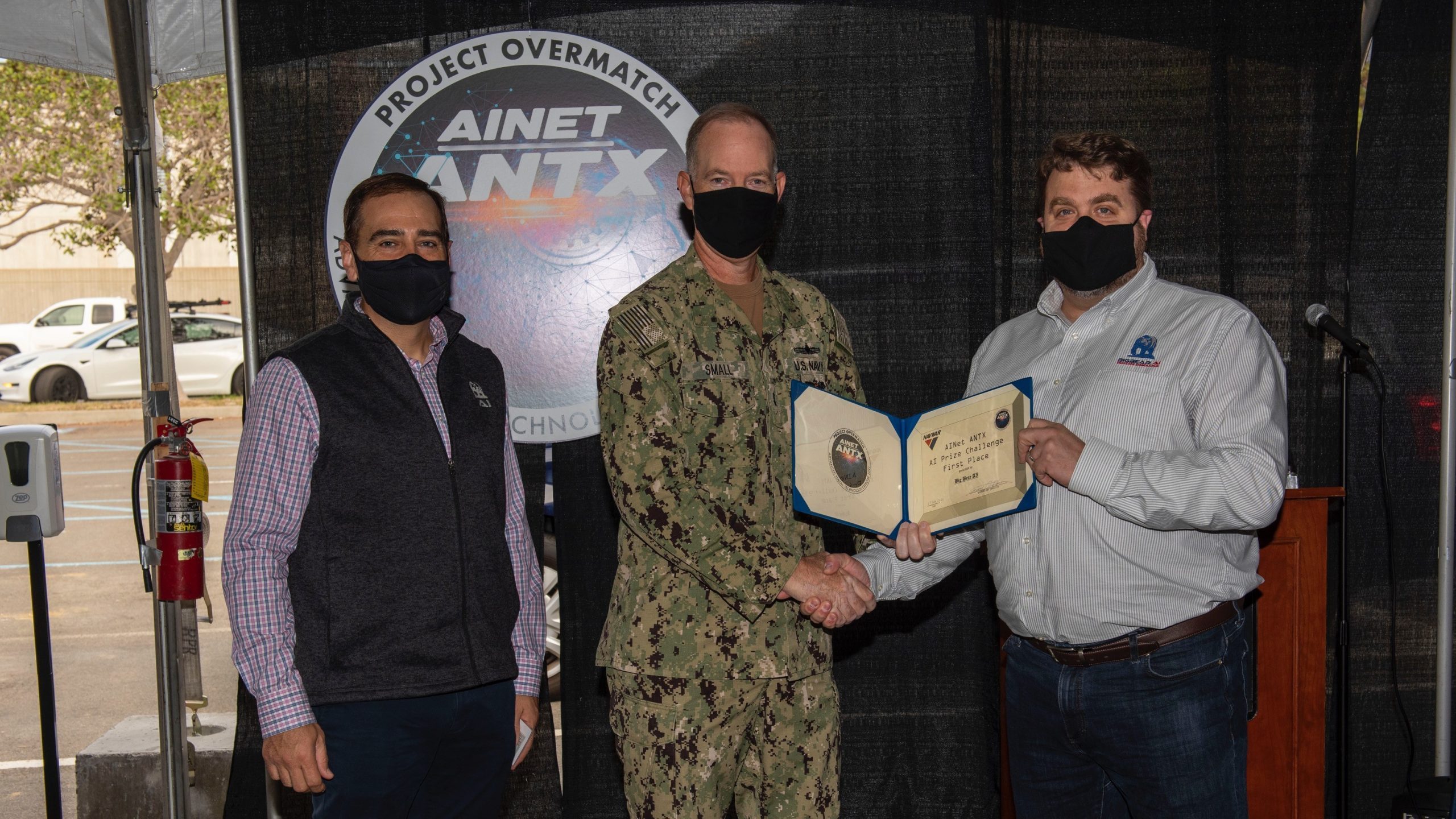
In a recent prize competition sponsored by the Department of Defense, a small company named BigBear.ai, headquartered in Columbia, Maryland, won the prize. The competition between 12 teams was a Project Overmatch AI Advanced Naval Technology Exercise, or ANTX.
Brian Frutchey, chief technology officer for BigBear.ai, said the company adapted for the Navy a program developed for the U.S Army, which was “dealing with hybrid warfare, the gray zone conflict out in Eastern Europe and wanting to find tools that could automate the sense-making of all of the different data that they need to look at for the hybrid warfare environment.”
It was not just “counting the planes and tanks and soldiers anymore,” Frutchey said. “They have to look at the economies, political relationships, migration of people, cyber activity, all these new domains that the strategic analyst needs to be cognizant of and needs to model into their anticipatory intelligence.”
BigBear.ai built the Virtual Anticipation Network (VANE) — the weathervane — to point to where the winds of war were blowing. Now the dominant product at Big Bear.ai, VANE, funded by the deputy assistant secretary of defense for Special Operations in Low Intensity Conflicts, was used by the company to win the $75,000 prize in the ANTX. BigBear.ai was one of 12 companies selected to participate in the competition, which was conducted during the last half of 2021.
Frutchey said in the ANTX the VANE was looking for telemetry for maritime vessels and aircraft, as well as weather, the information environment, among other domains “that we brought together so that we could inform when these things are happening with airplanes flying through the Taiwanese air defense zone [ADIZ],” including events leading up to and during the events of interest, such as Chinese aircraft entry into the ADIZ; rerouting of air traffic; even press releases. As the observation of the indicators is automated, human analysts are able to handle more data “and with a significant amount of agility be able to pivot to new situations faster than they could before.”
He says what sets BigBear.ai apart “is that we have built machine learning that expects data to not be the whole story. I think that’s key because especially for our defense and intelligence partners, you don’t always have control of the data that you’re trying to analyze. There’s always this uncertainty in the data where you have gaps and holes and inaccuracies and because of that we have to use machine learning that assumes that you’re going to be having those errors, those issues and, even further, you don’t always get to measure the stuff you want to measure.”
VANE presents its analysis on a dashboard on a monitor for analysts to observe. A “heat map or density chart” shows areas with a lot of activity in a given period.
“We also look at baseline behaviors,” Frutchey said. “The analysts get concerned when that level raises above some threshold. In the first week of October, it went to 56 [Chinese] sorties in a day at one point and they were using strategic bombers in some of those sorties. Those kinds of things are a normal low-level buzz, but I want to be alerted when the models predicting that a week from a now, a month from now, there is going to be above some threshold, or the rate of change is going to be significant. … We give them those alerts, and the user can, of course, then drill into the alert and explore the forecast data. … So, we were looking at aggressive activities in the South China Sea for the AI ANTX exercise.
“We also have scenario forecasts [that] allow you to assess courses of action,” he said. “What if Russia invades Ukraine? What will that do to the price of Bitcoin? Or what if, in the AI ANTX example, we asked the question, what if we ran a naval exercise in the Luzon Strait? What would that do to Chinese behaviors in the South China Sea? If we were to go with a carrier striker to the Luzon Strait and run a little naval exercise, what would that do to behaviors? And so, we can run those simulations and we can then show the user, here’s how the world would change a month from now if we were to run that exercise next week.”
VANE is scalable, Frutchey said. “Vane is built to elastically scale in the cloud as large as it needs to go. It’s actually one of the big powers on our platform is that it is completely serverless, which means it’s not like it’s a monolithic app that’s a bunch of servers chewing up resources all day long. It’s a collection of functions and, as the customers need those functions, the system is built to grab resources in the cloud, spin those up to do the work that’s needed and then turn them off when the work is done. Our systems churn through terabytes of data to build these models at global scales.”
Frutchey said the Overmatch ANTX win shows the company’s prescriptive analytics are appropriate for operational as well as strategic purposes.
“We are beginning to talk to the program offices for major command-and-control systems, [such as] the Global Command-and-Control System-Maritime,” he said.
Matching Best of Breed
AI is also being applied on a tactical level. Draper, a company known for building ballistic-missile guidance systems, entered a competition last summer conducted by the Naval Surface Warfare Center Crane Division in Crane, Indiana. The prize challenge was to determine the feasibility of taking autonomy software and implementing it on another organization’s hardware.
“I think what the government was trying to learn is how difficult is it to separate those two [software and hardware],” said Drew Mitchell, Defense Systems associate director at Draper and general manager of Draper’s Tampa, Florida, office. “That way I can match best of breed software up with best of breed hardware. Generally, those aren’t the same when the company delivers that end product to the government. And it’s also very expensive. So, they’re trying to figure out a way to reduce costs on some of these autonomous platforms.”
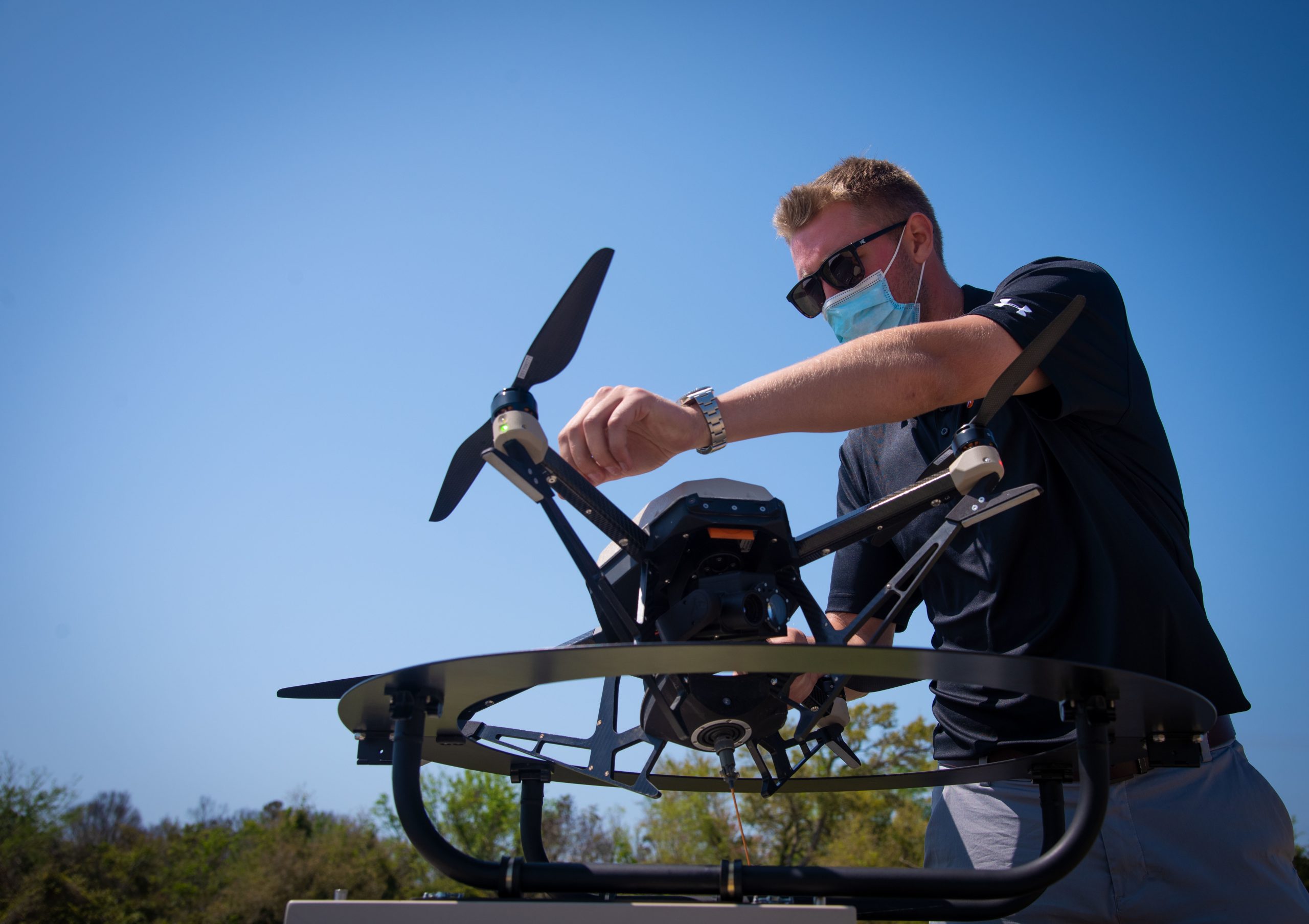
The prize challenge was split into three phases. In Phase 1, Draper, which had a lot of experience developing platform-agnostic software, submitted a white paper that was accepted along with those of 20 other companies. Phase 2 was a simulated exercise which involved loading autonomy algorithms into a small quadrotor unmanned aerial system and navigating it inside a building, mapping the interior and identifying objects in the building, all without the aid of GPS.
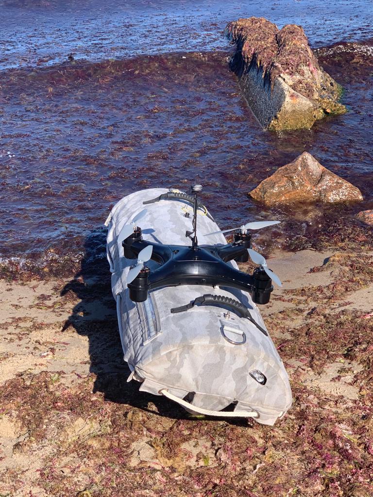
Five contestants made it to Phase 3, which involved an actual demonstration of the scenario of Phase 2 using a Hydronalix quadrotor drone into which their respective software was loaded.
“It was completely autonomous, so you give the drone some sort of basic instruction, basically, fly forward and then it takes it over from there,” Mitchell said. “It senses the environment, and it does that through cameras, and it uses the same camera to do the navigation algorithm using a vision-based navigation system. It uses the same camera to collect a map of the environment or generate a map of the environment. A lot of that is very processor intensive. In a small package, like a small drone quadcopter not much bigger than a book, there’s not a whole lot of processor available on there to do all that stuff.”
Draper used vision-aided navigation algorithms it has used in its other programs.
“We used what’s called a visual inertial odometry,” Mitchell said. “It’s a lot like how the human eye and brain work in terms of referencing objects as you see them and then as you move, your brain is still calculating, oh, I saw this point and now the point is three feet from me as I move closer to it, from that point it’s now two feet from me, and from that, you can infer a lot of direction. It’s not highly accurate but it’s enough accuracy to help the IMU [inertial measuring unit] on board. It aids the IMU, so the IMU doesn’t drift off widely.
“The predominant systems today use GPS to aid that inertial unit,” Mitchell explained. “GPS gives it a position, so it knows, okay, I see that point, and then I move again, I see that point, I know where I am. But if you’re indoors, GPS doesn’t work and the big push within the Department of Defense is to do things without GPS because they know in a future conflict it’s probably going to be one of the first things our adversaries take out. Using these vision-based techniques, you’re able to get clearly decent navigation accuracy in a very small package and do this completely autonomously.
“We were able to show with very little time and resources and a very rudimentary hardware platform that the government provided us, we were able to navigate inside of a building with no GPS,” he said. “We were able to identify objects. We were able to map certain parts of an environment. Of course, it wasn’t optimal. The places that we did on our own were way better than what we’d developed through that process, but we did help the government understand that it is possible to do it.”
Draper came in second in the prize competition, with EPISCI coming in first.