
Terradepth Mines Seabed Intelligence for Maritime Customers


Richard R. Burgess, is senior editor for Seapower magazine. He is a retired naval flight officer and author of several books on naval aviation.
By Richard R. Burgess, Senior Editor
ARLINGTON, Va. — The seabeds of the world’s oceans are becoming less mysterious, thanks to companies like Terradepth, a company that provides its clients with geospatial surveys of the seabed to meet their economic, defense, or scientific needs.
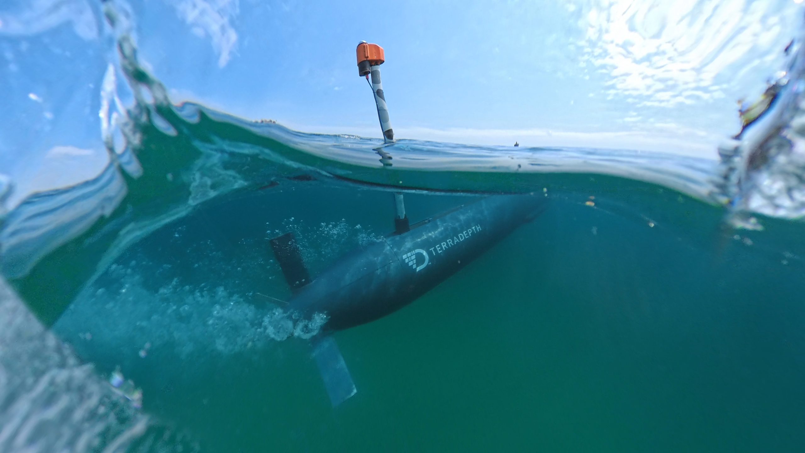
Terradepth Inc., founded in 2018 and based in Austin, Texas, with a facility in Panama Beach, Florida, provides customized robotic surveys of the seabed using autonomous unmanned underwater vehicles (AUVs) and provides data to its customers through its Absolute Ocean intelligence layer software platform for their awareness of their ocean systems and infrastructure.
“Absolute Ocean is a high-resolution map that pulls data from multiple information sources,” said Joe Wolfel, Terradepth founder and chief executive officer, in an interview with Seapower, noting that the data is collected and aggregated into one spot. “That ecosystem drives better and faster decision making [for customers] at scale.”
Wolfel explained that Terradepth takes some ocean data — from NOAA, for example — into the Absolute Ocean data platform that is publicly available to its customers.
“A lot of times customers want to keep their data private and secure, so they have access to al of the publicly available data and obviously their own data holdings in the geospatial platform, Absolute Ocean,” he said.
Wolfel told Seapower that his company builds and deploys its own AUVs and also uses AUVs built by other companies “to the extent that it makes sense.” The company deploys teams equipped with AUVs to areas to be surveyed. The teams can fly to ports worldwide and deploy on vessels of opportunity to execute their surveys. He said the “major cost driver of ocean data acquisition is the requirement for that surface vessel.”
Terradepth’s missions are varied: looking for mines, a leak in an oil pipeline, a break in a data transmission cable. Its data is used in sectors including defense and national security; maritime insurance, government; regulation; scientific research, offshore energy; and telecommunications, according to the company website.
Terradepth cooperates with other ocean technology companies such as Saildrone, Anduril, Kongsberg, and Oceaneering. Many of its customers and missions are not disclosable. Its customers have included NOAA. The U.S. Navy uses the company software for undersea applications.
Wolfel is a Naval Academy graduate, a former Navy SEAL officer who later worked for the McCrystal Group where he was exposed to a lot of emerging technologies, including Gate Technologies, that made “about half the world’s data storage,” he said. He recalled the 2005 collision of the attack submarine USS San Francisco with an uncharted seamount and how the incident highlighted the dearth of knowledge about the world’s seabeds.
“There was just a huge gap in our understanding of that environment,” he said. “That stuck with me … and gave me the opportunity to do something special.”
“We’re trying to drastically reduce human cognitive load with respect to high-resolution seabed data,” Wolfel said. “The amount of human involvement that occurs throughout that ocean operating system between data acquisition, data processing; before we built Absolute Ocean, we were keeping data on hard disk drives and Fedexing it around the world, or hand carrying them. We have to be able to reduce human in the loop, human on the loop with respect to that entire ecosystem,” referring to the ocean’s 310 billion square kilometers of seabed.